Baon geodata
Baon (Davao) is a populated place; located in Philippines in Asia/Manila (GMT+8) time zone. With population of 3,601 people, there are 1981 cities with bigger population in this country. Compared to other cities in Philippines, 93.2% of cities are located further ↑North; 98.4% of cities are located further ←West and 57.6% of cities have higher elevation than Baon. Note1


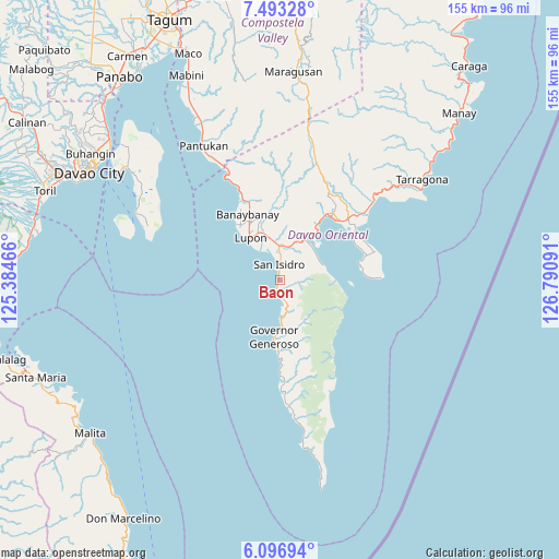
Baon GPS coordinates[2]
6° 47' 44.232" North, 126° 5' 16.008" East
| Map corner | latitude | longitude |
|---|---|---|
| Upper-left | 7.49328°, | 125.38466° |
| Center: | 6.79562°, | 126.08778° |
| Lower-right: | 6.09694°, | 126.79091° |
| Map W x H: | 155.3×155.3 km | = 96.5×96.5mi |
| max Lat: | 20.78733° ⇑93.2% North |
| Baon: | 6.79562° |
| min Lat: | ⇓6.8% South 4.65442° |
| min Long | Baon | max Long |
| 117.04868° | 126.08778° | 126.58417° |
| W 98.4%⇐ | ⇒1.6% E |
Elevation
Elevation of Baon is 18 m = 59 ft, and this is 69.9 m = 229 ft below average elevation for this country.
| Max E: |
2262 m = 7421 ft | 57.6% |
| Avg. | 87.9 m = 288 ft | |
| Baon | 18 m = 59 ft | |
Min E: |
-2 m = -7 ft | 42.4% |
See also: Philippines elevation on elevation.city.
Geographical zone
Baon is located in North Torrid zone (between Equator and Tropic of Cancer). Distance of Equator is 755.6 km =469.5 mi to South.| Distance of | km | miles | from Baon |
|---|---|---|---|
| North Pole | 9251.5 | 5748.6 | to North |
| Arctic Circle | 6645.6 | 4129.4 | to North |
| Tropic Cancer | 1850.3 | 1149.7 | to North |
| Equator | 755.6 | 469.5 | to South |


Nearby cities:
15 places around Baon: (largest is in red/bold)
• Banaybanay
20.1 km =12.5 mi,  337°
337°
• Batobato
3.3 km =2.1 mi,  353°
353°
• Bitaogan
3.2 km =2 mi,  200°
200°
• Davan
15.1 km =9.4 mi,  28°
28°
• Ilangay
13.7 km =8.5 mi, 342°
• La Union
10.2 km =6.3 mi,  179°
179°
• Linao
26.8 km =16.7 mi, 336°
• Lupon
14.3 km =8.9 mi,  322°
322°
• Manikling
9.8 km =6.1 mi, 342°
• Mati
22.7 km =14.1 mi,  38°
38°
• Panikian
24.9 km =15.5 mi, 343°
• Sigaboy
15.8 km =9.8 mi,  186°
186°
• Talisay
8.5 km =5.3 mi,  170°
170°
• Tamisan
23.9 km =14.9 mi,  77°
77°
• Tibanbang
18.3 km =11.4 mi, 173°
Sources, notices
• [Note1] Compared only with cities in Philippines existing in our database
• [Src1] Map data: © OpenStreetMap contributors (CC-BY-SA)
• [Src2] Other city data from geonames.org with taken over terms of usage.
• [Src3] Geographical zone / Annual Mean Temperature by Robert A. Rohde @ Wikipedia
