Subic geodata
Subic (Calabarzon) is a populated place; located in Philippines in Asia/Manila (GMT+8) time zone. With population of 8,881 people, there are 699 cities with bigger population in this country. Compared to other cities in Philippines, 68.3% of cities are located further ↓South; 78.1% of cities are located further →East and 53.1% of cities have higher elevation than Subic. Note1


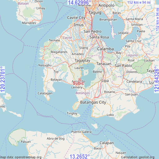
Subic GPS coordinates[2]
13° 56' 54.924" North, 120° 56' 24.468" East
| Map corner | latitude | longitude |
|---|---|---|
| Upper-left | 14.62996°, | 120.23701° |
| Center: | 13.94859°, | 120.94013° |
| Lower-right: | 13.2652°, | 121.64326° |
| Map W x H: | 151.7×151.7 km | = 94.3×94.3mi |
| max Lat: | 20.78733° ⇑31.7% North |
| Subic: | 13.94859° |
| min Lat: | ⇓68.3% South 4.65442° |
| min Long | Subic | max Long |
| 117.04868° | 120.94013° | 126.58417° |
| W 21.9%⇐ | ⇒78.1% E |
Elevation
Elevation of Subic is 21 m = 69 ft, and this is 66.9 m = 219 ft below average elevation for this country.
| Max E: |
2262 m = 7421 ft | 53.1% |
| Avg. | 87.9 m = 288 ft | |
| Subic | 21 m = 69 ft | |
Min E: |
-2 m = -7 ft | 46.9% |
See also: Philippines elevation on elevation.city.
Geographical zone
Subic is located in North Torrid zone (between Equator and Tropic of Cancer). Distance of this Northern Tropic circle is 1055 km =655.5 mi to North.| Distance of | km | miles | from Subic |
|---|---|---|---|
| North Pole | 8456.1 | 5254.4 | to North |
| Arctic Circle | 5850.2 | 3635.1 | to North |
| Tropic Cancer | 1055 | 655.5 | to North |
| Equator | 1550.9 | 963.7 | to South |


Nearby cities:
15 places around Subic: (largest is in red/bold)
• Agoncillo
1.7 km =1.1 mi,  209°
209°
• Alitagtag
11.6 km =7.2 mi,  143°
143°
• Bugaan
10.2 km =6.3 mi,  357°
357°
• Dayapan
2.9 km =1.8 mi,  243°
243°
• Laurel
12.1 km =7.5 mi,  349°
349°
• Lemery
8 km =5 mi,  200°
200°
• Matingain
7.6 km =4.7 mi, 238°
• Mozon
11.9 km =7.4 mi,  153°
153°
• Payapa
7.6 km =4.7 mi,  316°
316°
• San Jose
10.8 km =6.7 mi,  174°
174°
• San Luis
10.7 km =6.6 mi,  193°
193°
• San Nicolas
2.5 km =1.6 mi, 152°
• Santa Teresita
10.2 km =6.3 mi, 154°
• Sinisian
11 km =6.8 mi,  250°
250°
• Taal
7.9 km =4.9 mi, 193°
Sources, notices
• [Note1] Compared only with cities in Philippines existing in our database
• [Src1] Map data: © OpenStreetMap contributors (CC-BY-SA)
• [Src2] Other city data from geonames.org with taken over terms of usage.
• [Src3] Geographical zone / Annual Mean Temperature by Robert A. Rohde @ Wikipedia
