Payapa geodata
Payapa (Calabarzon) is a populated place; located in Philippines in Asia/Manila (GMT+8) time zone. With population of 4,358 people, there are 1555 cities with bigger population in this country. Compared to other cities in Philippines, 69% of cities are located further ↓South; 79.7% of cities are located further →East and 93.6% of cities have lower elevation than Payapa. Note1


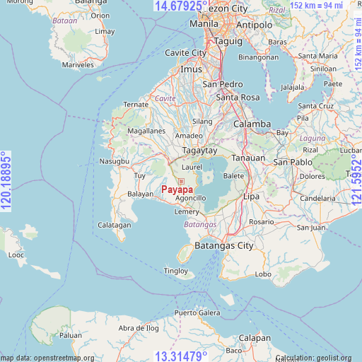
Payapa GPS coordinates[2]
13° 59' 52.908" North, 120° 53' 31.452" East
| Map corner | latitude | longitude |
|---|---|---|
| Upper-left | 14.67925°, | 120.18895° |
| Center: | 13.99803°, | 120.89207° |
| Lower-right: | 13.31479°, | 121.5952° |
| Map W x H: | 151.7×151.7 km | = 94.3×94.3mi |
| max Lat: | 20.78733° ⇑31% North |
| Payapa: | 13.99803° |
| min Lat: | ⇓69% South 4.65442° |
| min Long | Payapa | max Long |
| 117.04868° | 120.89207° | 126.58417° |
| W 20.3%⇐ | ⇒79.7% E |
Elevation
Elevation of Payapa is 358 m = 1175 ft, and this is 270.1 m = 886 ft above average elevation for this country.
| Max E: |
2262 m = 7421 ft | 6.4% |
| Payapa | 358 m 1175 ft | |
| Avg. | 87.9 m = 288 ft | |
Min E: |
-2 m = -7 ft | 93.6% |
See also: Philippines elevation on elevation.city.
Geographical zone
Payapa is located in North Torrid zone (between Equator and Tropic of Cancer). Distance of this Northern Tropic circle is 1049.5 km =652.1 mi to North.| Distance of | km | miles | from Payapa |
|---|---|---|---|
| North Pole | 8450.6 | 5251 | to North |
| Arctic Circle | 5844.7 | 3631.7 | to North |
| Tropic Cancer | 1049.5 | 652.1 | to North |
| Equator | 1556.4 | 967.1 | to South |


Nearby cities:
15 places around Payapa: (largest is in red/bold)
• Agoncillo
8.2 km =5.1 mi,  147°
147°
• Bugaan
6.6 km =4.1 mi,  45°
45°
• Calaca
11.2 km =7 mi,  229°
229°
• Calantas
13 km =8.1 mi,  257°
257°
• Dayapan
7.2 km =4.5 mi,  158°
158°
• Laurel
7 km =4.3 mi,  24°
24°
• Lemery
13.2 km =8.2 mi,  169°
169°
• Luksuhin
11 km =6.8 mi,  353°
353°
• Matingain
9.6 km =6 mi,  187°
187°
• Sampaloc
13.1 km =8.1 mi,  40°
40°
• San Nicolas
10 km =6.2 mi,  140°
140°
• Sinisian
10.5 km =6.5 mi,  209°
209°
• Subic
7.6 km =4.7 mi, 136°
• Taal
13.6 km =8.5 mi, 165°
• Tagaytay
11.7 km =7.3 mi, 22°
Sources, notices
• [Note1] Compared only with cities in Philippines existing in our database
• [Src1] Map data: © OpenStreetMap contributors (CC-BY-SA)
• [Src2] Other city data from geonames.org with taken over terms of usage.
• [Src3] Geographical zone / Annual Mean Temperature by Robert A. Rohde @ Wikipedia
