Sibutao geodata
Sibutao (Zamboanga Peninsula) is a populated place; located in Philippines in Asia/Manila (GMT+8) time zone. With population of 3,395 people, there are 2140 cities with bigger population in this country. Compared to other cities in Philippines, 77.7% of cities are located further ↑North; 61.9% of cities are located further ←West and 54.5% of cities have higher elevation than Sibutao. Note1
Administrative division(s):
- Level 1: Zamboanga Peninsula
- Level 2: Province of Zamboanga del Norte
- Level 3: Sibutad


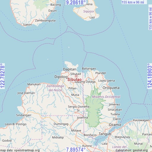
Sibutao GPS coordinates[2]
8° 35' 29.76" North, 123° 29' 9.24" East
| Map corner | latitude | longitude |
|---|---|---|
| Upper-left | 9.28618°, | 122.78278° |
| Center: | 8.5916°, | 123.4859° |
| Lower-right: | 7.89574°, | 124.18903° |
| Map W x H: | 154.6×154.6 km | = 96.1×96.1mi |
| max Lat: | 20.78733° ⇑77.7% North |
| Sibutao: | 8.5916° |
| min Lat: | ⇓22.3% South 4.65442° |
| min Long | Sibutao | max Long |
| 117.04868° | 123.4859° | 126.58417° |
| W 61.9%⇐ | ⇒38.1% E |
Elevation
Elevation of Sibutao is 20 m = 66 ft, and this is 67.9 m = 223 ft below average elevation for this country.
| Max E: |
2262 m = 7421 ft | 54.5% |
| Avg. | 87.9 m = 288 ft | |
| Sibutao | 20 m = 66 ft | |
Min E: |
-2 m = -7 ft | 45.5% |
See also: Philippines elevation on elevation.city.
Geographical zone
Sibutao is located in North Torrid zone (between Equator and Tropic of Cancer). Distance of Equator is 955.3 km =593.6 mi to South.| Distance of | km | miles | from Sibutao |
|---|---|---|---|
| North Pole | 9051.8 | 5624.5 | to North |
| Arctic Circle | 6445.9 | 4005.3 | to North |
| Tropic Cancer | 1650.6 | 1025.6 | to North |
| Equator | 955.3 | 593.6 | to South |


Nearby cities:
15 places around Sibutao: (largest is in red/bold)
• Barcelona
7.7 km =4.8 mi,  202°
202°
• Bato
17.5 km =10.9 mi,  85°
85°
• Calamba
17.6 km =10.9 mi,  101°
101°
• Dapitan
10 km =6.2 mi,  315°
315°
• Dipolog
16.8 km =10.4 mi,  260°
260°
• Ilaya
7.9 km =4.9 mi,  230°
230°
• Katipunan
23.9 km =14.9 mi,  248°
248°
• Langatian
29 km =18 mi, 254°
• Lingasan
14.2 km =8.8 mi,  221°
221°
• Olingan
19 km =11.8 mi, 251°
• Plaridel
24.9 km =15.5 mi,  82°
82°
• Polanco
15.1 km =9.4 mi,  244°
244°
• Sapang Dalaga
10.2 km =6.3 mi,  124°
124°
• Seres
27.5 km =17.1 mi, 243°
• Unidos
20 km =12.4 mi, 89°
Sources, notices
• [Note1] Compared only with cities in Philippines existing in our database
• [Src1] Map data: © OpenStreetMap contributors (CC-BY-SA)
• [Src2] Other city data from geonames.org with taken over terms of usage.
• [Src3] Geographical zone / Annual Mean Temperature by Robert A. Rohde @ Wikipedia
