Santa Lucia geodata
Santa Lucia (Central Luzon) is a populated place; located in Philippines in Asia/Manila (GMT+8) time zone. With population of 4,090 people, there are 1670 cities with bigger population in this country. Compared to other cities in Philippines, 81.5% of cities are located further ↓South; 82.9% of cities are located further →East and 50.3% of cities have higher elevation than Santa Lucia. Note1
Administrative division(s):
- Level 1: Central Luzon
- Level 2: Province of Nueva Ecija
- Level 3: Zaragoza


Santa Lucia GPS coordinates[2]
15° 28' 54.624" North, 120° 46' 28.416" East
| Map corner | latitude | longitude |
|---|---|---|
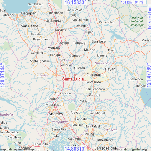
| Upper-left | 16.15833°, | 120.07144° |
| Center: | 15.48184°, | 120.77456° |
| Lower-right: | 14.80313°, | 121.47769° |
| Map W x H: | 150.7×150.7 km | = 93.6×93.6mi |
| max Lat: | 20.78733° ⇑18.5% North |
| Santa Lucia: | 15.48184° |
| min Lat: | ⇓81.5% South 4.65442° |
| min Long | Santa Lucia | max Long |
| 117.04868° | 120.77456° | 126.58417° |
| W 17.1%⇐ | ⇒82.9% E |
Elevation
Elevation of Santa Lucia is 23 m = 75 ft, and this is 64.9 m = 213 ft below average elevation for this country.
| Max E: |
2262 m = 7421 ft | 50.3% |
| Avg. | 87.9 m = 288 ft | |
| Santa Lucia | 23 m = 75 ft | |
Min E: |
-2 m = -7 ft | 49.7% |
See also: Philippines elevation on elevation.city.
Geographical zone
Santa Lucia is located in North Torrid zone (between Equator and Tropic of Cancer). Distance of this Northern Tropic circle is 884.5 km =549.6 mi to North.| Distance of | km | miles | from Santa Lucia |
|---|---|---|---|
| North Pole | 8285.6 | 5148.4 | to North |
| Arctic Circle | 5679.8 | 3529.3 | to North |
| Tropic Cancer | 884.5 | 549.6 | to North |
| Equator | 1721.4 | 1069.6 | to South |


Nearby cities:
15 places around Santa Lucia: (largest is in red/bold)
• Aliaga
7.6 km =4.7 mi,  74°
74°
• Bundoc
6.1 km =3.8 mi,  274°
274°
• Carmen
6.8 km =4.2 mi,  124°
124°
• Concepcion
5 km =3.1 mi,  146°
146°
• La Paz
6.7 km =4.2 mi,  227°
227°
• Licab
7 km =4.3 mi,  350°
350°
• Lomboy
6.3 km =3.9 mi,  280°
280°
• Macarse
6.3 km =3.9 mi,  179°
179°
• Matayumtayum
7.9 km =4.9 mi,  299°
299°
• Quezon
8.8 km =5.5 mi,  29°
29°
• San Casimiro
7.9 km =4.9 mi,  4°
4°
• San Cristobal
8 km =5 mi, 354°
• San Isidro
6.8 km =4.2 mi, 230°
• Santa Maria
5 km =3.1 mi,  22°
22°
• Villarosa
8 km =5 mi,  340°
340°
Sources, notices
• [Note1] Compared only with cities in Philippines existing in our database
• [Src1] Map data: © OpenStreetMap contributors (CC-BY-SA)
• [Src2] Other city data from geonames.org with taken over terms of usage.
• [Src3] Geographical zone / Annual Mean Temperature by Robert A. Rohde @ Wikipedia
