Santa Maria geodata
Santa Maria (Central Luzon) is a populated place; located in Philippines in Asia/Manila (GMT+8) time zone. With population of 3,753 people, there are 1878 cities with bigger population in this country. Compared to other cities in Philippines, 81.9% of cities are located further ↓South; 82.4% of cities are located further →East and 54.4% of cities have lower elevation than Santa Maria. Note1


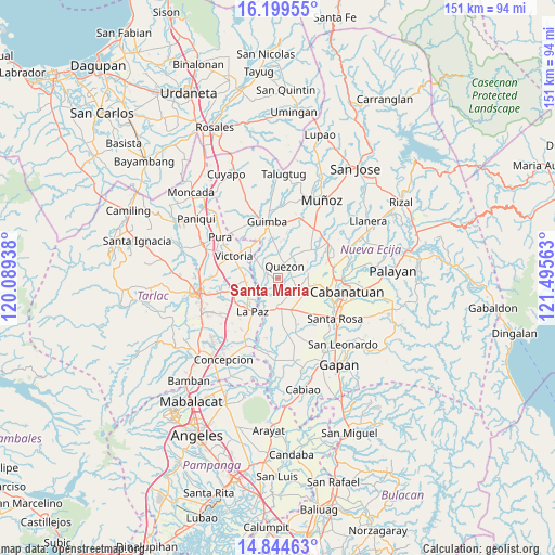
Santa Maria GPS coordinates[2]
15° 31' 23.52" North, 120° 47' 33" East
| Map corner | latitude | longitude |
|---|---|---|
| Upper-left | 16.19955°, | 120.08938° |
| Center: | 15.5232°, | 120.7925° |
| Lower-right: | 14.84463°, | 121.49563° |
| Map W x H: | 150.7×150.7 km | = 93.6×93.6mi |
| max Lat: | 20.78733° ⇑18.1% North |
| Santa Maria: | 15.5232° |
| min Lat: | ⇓81.9% South 4.65442° |
| min Long | Santa Maria | max Long |
| 117.04868° | 120.7925° | 126.58417° |
| W 17.6%⇐ | ⇒82.4% E |
Elevation
Elevation of Santa Maria is 27 m = 89 ft, and this is 60.9 m = 200 ft below average elevation for this country.
| Max E: |
2262 m = 7421 ft | 45.6% |
| Avg. | 87.9 m = 288 ft | |
| Santa Maria | 27 m = 89 ft | |
Min E: |
-2 m = -7 ft | 54.4% |
See also: Philippines elevation on elevation.city.
Geographical zone
Santa Maria is located in North Torrid zone (between Equator and Tropic of Cancer). Distance of this Northern Tropic circle is 879.9 km =546.7 mi to North.| Distance of | km | miles | from Santa Maria |
|---|---|---|---|
| North Pole | 8281 | 5145.6 | to North |
| Arctic Circle | 5675.2 | 3526.4 | to North |
| Tropic Cancer | 879.9 | 546.7 | to North |
| Equator | 1726 | 1072.5 | to South |


Nearby cities:
15 places around Santa Maria: (largest is in red/bold)
• Aliaga
6 km =3.7 mi,  115°
115°
• Bibiclat
7.5 km =4.7 mi,  91°
91°
• Bundoc
9.1 km =5.7 mi,  242°
242°
• Concepcion
8.8 km =5.5 mi,  174°
174°
• Licab
3.9 km =2.4 mi,  306°
306°
• Lomboy
8.8 km =5.5 mi,  247°
247°
• Manacsac
8 km =5 mi,  358°
358°
• Matayumtayum
8.9 km =5.5 mi,  265°
265°
• Nagpandayan
9.1 km =5.7 mi,  343°
343°
• Quezon
3.9 km =2.4 mi,  37°
37°
• San Alejandro
7.4 km =4.6 mi,  55°
55°
• San Casimiro
3.5 km =2.2 mi, 339°
• San Cristobal
4.4 km =2.7 mi,  321°
321°
• Santa Lucia
5 km =3.1 mi,  202°
202°
• Villarosa
5.4 km =3.4 mi,  303°
303°
Sources, notices
• [Note1] Compared only with cities in Philippines existing in our database
• [Src1] Map data: © OpenStreetMap contributors (CC-BY-SA)
• [Src2] Other city data from geonames.org with taken over terms of usage.
• [Src3] Geographical zone / Annual Mean Temperature by Robert A. Rohde @ Wikipedia
