Carmen geodata
Carmen (Central Luzon) is a populated place; located in Philippines in Asia/Manila (GMT+8) time zone. With population of 2,835 people, there are 2731 cities with bigger population in this country. Compared to other cities in Philippines, 81.2% of cities are located further ↓South; 81.6% of cities are located further →East and 52.3% of cities have lower elevation than Carmen. Note1
Administrative division(s):
- Level 1: Central Luzon
- Level 2: Province of Nueva Ecija
- Level 3: Zaragoza


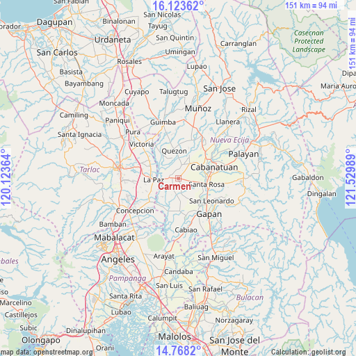
Carmen GPS coordinates[2]
15° 26' 49.272" North, 120° 49' 36.336" East
| Map corner | latitude | longitude |
|---|---|---|
| Upper-left | 16.12362°, | 120.12364° |
| Center: | 15.44702°, | 120.82676° |
| Lower-right: | 14.7682°, | 121.52989° |
| Map W x H: | 150.7×150.7 km | = 93.6×93.6mi |
| max Lat: | 20.78733° ⇑18.8% North |
| Carmen: | 15.44702° |
| min Lat: | ⇓81.2% South 4.65442° |
| min Long | Carmen | max Long |
| 117.04868° | 120.82676° | 126.58417° |
| W 18.4%⇐ | ⇒81.6% E |
Elevation
Elevation of Carmen is 25 m = 82 ft, and this is 62.9 m = 206 ft below average elevation for this country.
| Max E: |
2262 m = 7421 ft | 47.7% |
| Avg. | 87.9 m = 288 ft | |
| Carmen | 25 m = 82 ft | |
Min E: |
-2 m = -7 ft | 52.3% |
See also: Philippines elevation on elevation.city.
Geographical zone
Carmen is located in North Torrid zone (between Equator and Tropic of Cancer). Distance of this Northern Tropic circle is 888.4 km =552 mi to North.| Distance of | km | miles | from Carmen |
|---|---|---|---|
| North Pole | 8289.5 | 5150.9 | to North |
| Arctic Circle | 5683.6 | 3531.6 | to North |
| Tropic Cancer | 888.4 | 552 | to North |
| Equator | 1717.5 | 1067.2 | to South |


Nearby cities:
15 places around Carmen: (largest is in red/bold)
• Aliaga
6.1 km =3.8 mi,  16°
16°
• Batitang
5.8 km =3.6 mi,  206°
206°
• Bibiclat
9.2 km =5.7 mi, 24°
• Cama Juan
8.7 km =5.4 mi,  225°
225°
• Concepcion
2.8 km =1.7 mi,  264°
264°
• Lambakin
9.1 km =5.7 mi,  156°
156°
• Macarse
6.1 km =3.8 mi,  246°
246°
• Marawa
3.5 km =2.2 mi, 159°
• Panabingan
10.2 km =6.3 mi,  220°
220°
• Putlod
9.6 km =6 mi,  152°
152°
• Rajal Norte
3.8 km =2.4 mi,  93°
93°
• Santa Barbara
7.6 km =4.7 mi, 205°
• Santa Lucia
6.8 km =4.2 mi,  304°
304°
• Santa Maria
9.2 km =5.7 mi,  336°
336°
• Santo Rosario
6.9 km =4.3 mi,  101°
101°
Sources, notices
• [Note1] Compared only with cities in Philippines existing in our database
• [Src1] Map data: © OpenStreetMap contributors (CC-BY-SA)
• [Src2] Other city data from geonames.org with taken over terms of usage.
• [Src3] Geographical zone / Annual Mean Temperature by Robert A. Rohde @ Wikipedia
