San Guillermo geodata
San Guillermo (Cagayan Valley) is a seat of a third-order administrative division; located in Philippines in Asia/Manila (GMT+8) time zone. With population of 3,926 people, there are 1771 cities with bigger population in this country. Compared to other cities in Philippines, 91.9% of cities are located further ↓South; 62.5% of cities are located further →East and 81.4% of cities have lower elevation than San Guillermo. Note1
Administrative division(s):
- Level 1: Cagayan Valley
- Level 2: Province of Isabela
- Level 3: San Guillermo


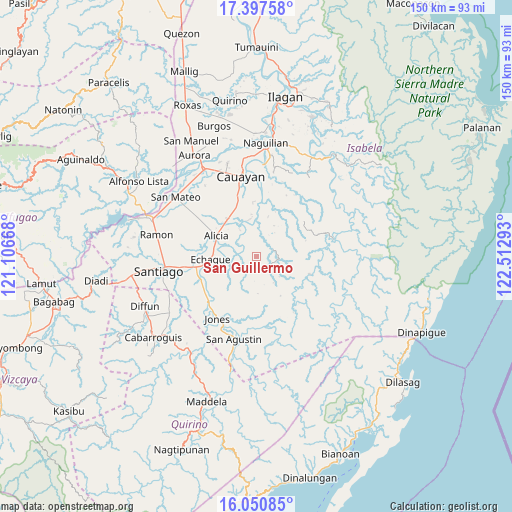
San Guillermo GPS coordinates[2]
16° 43' 31.44" North, 121° 48' 35.28" East
| Map corner | latitude | longitude |
|---|---|---|
| Upper-left | 17.39758°, | 121.10668° |
| Center: | 16.7254°, | 121.8098° |
| Lower-right: | 16.05085°, | 122.51293° |
| Map W x H: | 149.7×149.7 km | = 93×93mi |
| max Lat: | 20.78733° ⇑8.1% North |
| San Guillermo: | 16.7254° |
| min Lat: | ⇓91.9% South 4.65442° |
| min Long | San Guillermo | max Long |
| 117.04868° | 121.8098° | 126.58417° |
| W 37.5%⇐ | ⇒62.5% E |
Elevation
Elevation of San Guillermo is 102 m = 335 ft, and this is 14.1 m = 46 ft above average elevation for this country.
| Max E: |
2262 m = 7421 ft | 18.6% |
| San Guillermo | 102 m 335 ft | |
| Avg. | 87.9 m = 288 ft | |
Min E: |
-2 m = -7 ft | 81.4% |
See also: Philippines elevation on elevation.city.
Geographical zone
San Guillermo is located in North Torrid zone (between Equator and Tropic of Cancer). Distance of this Northern Tropic circle is 746.2 km =463.7 mi to North.| Distance of | km | miles | from San Guillermo |
|---|---|---|---|
| North Pole | 8147.4 | 5062.6 | to North |
| Arctic Circle | 5541.5 | 3443.3 | to North |
| Tropic Cancer | 746.2 | 463.7 | to North |
| Equator | 1859.7 | 1155.6 | to South |


Nearby cities:
15 places around San Guillermo: (largest is in red/bold)
• Alicia
13.4 km =8.3 mi,  296°
296°
• Angadanan
7.3 km =4.5 mi, 296°
• Burgos
13.7 km =8.5 mi,  323°
323°
• Dicamay
20.9 km =13 mi,  80°
80°
• Echague
14.4 km =8.9 mi,  260°
260°
• Gappal
12.4 km =7.7 mi,  5°
5°
• Jones
21.9 km =13.6 mi,  211°
211°
• Malasin
9.2 km =5.7 mi,  342°
342°
• Minante Segundo
20.3 km =12.6 mi,  345°
345°
• Pangal Sur
20.4 km =12.7 mi,  227°
227°
• Pinoma
19.9 km =12.4 mi,  326°
326°
• Ramos West
21.1 km =13.1 mi, 261°
• San Isidro
20.6 km =12.8 mi,  272°
272°
• Sillawit
17.3 km =10.7 mi, 341°
• Soyung
15.6 km =9.7 mi, 259°
Sources, notices
• [Note1] Compared only with cities in Philippines existing in our database
• [Src1] Map data: © OpenStreetMap contributors (CC-BY-SA)
• [Src2] Other city data from geonames.org with taken over terms of usage.
• [Src3] Geographical zone / Annual Mean Temperature by Robert A. Rohde @ Wikipedia
