Sillawit geodata
Sillawit (Cagayan Valley) is a populated place; located in Philippines in Asia/Manila (GMT+8) time zone. With population of 3,084 people, there are 2437 cities with bigger population in this country. Compared to other cities in Philippines, 92.7% of cities are located further ↓South; 63.2% of cities are located further →East and 73.4% of cities have lower elevation than Sillawit. Note1
Administrative division(s):
- Level 1: Cagayan Valley
- Level 2: Province of Isabela
- Level 3: City of Cauayan


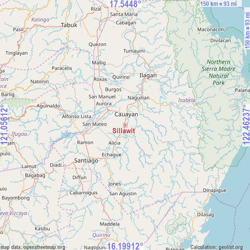
Sillawit GPS coordinates[2]
16° 52' 23.376" North, 121° 45' 33.264" East
| Map corner | latitude | longitude |
|---|---|---|
| Upper-left | 17.5448°, | 121.05612° |
| Center: | 16.87316°, | 121.75924° |
| Lower-right: | 16.19912°, | 122.46237° |
| Map W x H: | 149.6×149.6 km | = 93×93mi |
| max Lat: | 20.78733° ⇑7.3% North |
| Sillawit: | 16.87316° |
| min Lat: | ⇓92.7% South 4.65442° |
| min Long | Sillawit | max Long |
| 117.04868° | 121.75924° | 126.58417° |
| W 36.8%⇐ | ⇒63.2% E |
Elevation
Elevation of Sillawit is 62 m = 203 ft, and this is 25.9 m = 85 ft below average elevation for this country.
| Max E: |
2262 m = 7421 ft | 26.6% |
| Avg. | 87.9 m = 288 ft | |
| Sillawit | 62 m = 203 ft | |
Min E: |
-2 m = -7 ft | 73.4% |
See also: Philippines elevation on elevation.city.
Geographical zone
Sillawit is located in North Torrid zone (between Equator and Tropic of Cancer). Distance of this Northern Tropic circle is 729.8 km =453.5 mi to North.| Distance of | km | miles | from Sillawit |
|---|---|---|---|
| North Pole | 8130.9 | 5052.3 | to North |
| Arctic Circle | 5525.1 | 3433.1 | to North |
| Tropic Cancer | 729.8 | 453.5 | to North |
| Equator | 1876.1 | 1165.8 | to South |


Nearby cities:
15 places around Sillawit: (largest is in red/bold)
• Alicia
12.3 km =7.6 mi,  212°
212°
• Angadanan
13.2 km =8.2 mi,  185°
185°
• Burgos
6.1 km =3.8 mi, 207°
• Cabatuan
13.4 km =8.3 mi,  313°
313°
• Cauayan
7 km =4.3 mi,  11°
11°
• Gappal
7.8 km =4.8 mi,  121°
121°
• La Paz
10.5 km =6.5 mi,  293°
293°
• Luna
11.2 km =7 mi,  343°
343°
• Magdalena
13.3 km =8.3 mi, 311°
• Malasin
8.1 km =5 mi,  160°
160°
• Minante Segundo
3.2 km =2 mi, 5°
• Nagrumbuan
6 km =3.7 mi,  299°
299°
• Pinoma
5.6 km =3.5 mi,  271°
271°
• Reina Mercedes
14.4 km =8.9 mi,  29°
29°
• San Luis
12.5 km =7.8 mi,  35°
35°
Sources, notices
• [Note1] Compared only with cities in Philippines existing in our database
• [Src1] Map data: © OpenStreetMap contributors (CC-BY-SA)
• [Src2] Other city data from geonames.org with taken over terms of usage.
• [Src3] Geographical zone / Annual Mean Temperature by Robert A. Rohde @ Wikipedia
