Minante Segundo geodata
Minante Segundo (Cagayan Valley) is a populated place; located in Philippines in Asia/Manila (GMT+8) time zone. With population of 6,697 people, there are 936 cities with bigger population in this country. Compared to other cities in Philippines, 93% of cities are located further ↓South; 63.1% of cities are located further →East and 73.6% of cities have lower elevation than Minante Segundo. Note1
Administrative division(s):
- Level 1: Cagayan Valley
- Level 2: Province of Isabela
- Level 3: City of Cauayan


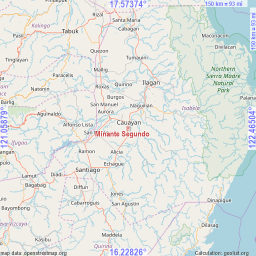
Minante Segundo GPS coordinates[2]
16° 54' 7.92" North, 121° 45' 42.876" East
| Map corner | latitude | longitude |
|---|---|---|
| Upper-left | 17.57374°, | 121.05879° |
| Center: | 16.9022°, | 121.76191° |
| Lower-right: | 16.22826°, | 122.46504° |
| Map W x H: | 149.6×149.6 km | = 93×93mi |
| max Lat: | 20.78733° ⇑7% North |
| Minante Segundo: | 16.9022° |
| min Lat: | ⇓93% South 4.65442° |
| min Long | Minante Segundo | max Long |
| 117.04868° | 121.76191° | 126.58417° |
| W 36.9%⇐ | ⇒63.1% E |
Elevation
Elevation of Minante Segundo is 63 m = 207 ft, and this is 24.9 m = 82 ft below average elevation for this country.
| Max E: |
2262 m = 7421 ft | 26.4% |
| Avg. | 87.9 m = 288 ft | |
| Minante Segundo | 63 m = 207 ft | |
Min E: |
-2 m = -7 ft | 73.6% |
See also: Philippines elevation on elevation.city.
Geographical zone
Minante Segundo is located in North Torrid zone (between Equator and Tropic of Cancer). Distance of this Northern Tropic circle is 726.6 km =451.5 mi to North.| Distance of | km | miles | from Minante Segundo |
|---|---|---|---|
| North Pole | 8127.7 | 5050.3 | to North |
| Arctic Circle | 5521.8 | 3431.1 | to North |
| Tropic Cancer | 726.6 | 451.5 | to North |
| Equator | 1879.3 | 1167.7 | to South |


Nearby cities:
15 places around Minante Segundo: (largest is in red/bold)
• Banquero
13.6 km =8.5 mi,  7°
7°
• Burgos
9.2 km =5.7 mi,  199°
199°
• Cabatuan
11.6 km =7.2 mi,  301°
301°
• Cauayan
3.8 km =2.4 mi,  17°
17°
• Gappal
9.7 km =6 mi,  138°
138°
• La Paz
10 km =6.2 mi,  275°
275°
• Luna
8.3 km =5.2 mi,  335°
335°
• Magdalena
11.7 km =7.3 mi, 298°
• Malasin
11.1 km =6.9 mi,  167°
167°
• Minallo
13.6 km =8.5 mi,  46°
46°
• Nagrumbuan
5.6 km =3.5 mi,  266°
266°
• Pinoma
6.6 km =4.1 mi,  242°
242°
• Reina Mercedes
11.5 km =7.1 mi,  36°
36°
• San Luis
9.9 km =6.2 mi, 45°
• Sillawit
3.2 km =2 mi,  185°
185°
Sources, notices
• [Note1] Compared only with cities in Philippines existing in our database
• [Src1] Map data: © OpenStreetMap contributors (CC-BY-SA)
• [Src2] Other city data from geonames.org with taken over terms of usage.
• [Src3] Geographical zone / Annual Mean Temperature by Robert A. Rohde @ Wikipedia
