San Fernando geodata
San Fernando (Ilocos) is a seat of a second-order administrative division; located in Philippines in Asia/Manila (GMT+8) time zone. With population of 83,003 people, there are 112 cities with bigger population in this country. Compared to other cities in Philippines, 91.5% of cities are located further ↓South; 95.2% of cities are located further →East and 80.7% of cities have higher elevation than San Fernando. Note1
Administrative division(s):
- Level 1: Ilocos
- Level 2: Province of La Union
- Level 3: City of San Fernando


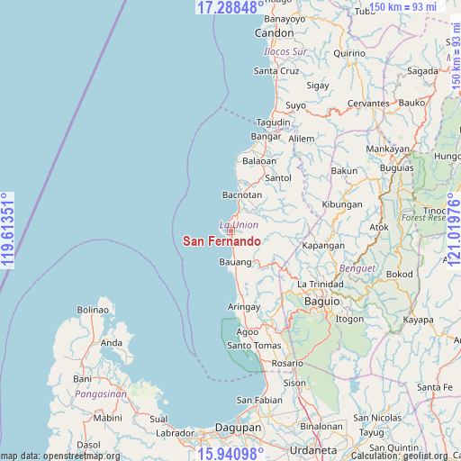
San Fernando GPS coordinates[2]
16° 36' 57.276" North, 120° 18' 59.868" East
| Map corner | latitude | longitude |
|---|---|---|
| Upper-left | 17.28848°, | 119.61351° |
| Center: | 16.61591°, | 120.31663° |
| Lower-right: | 15.94098°, | 121.01976° |
| Map W x H: | 149.8×149.8 km | = 93.1×93.1mi |
| max Lat: | 20.78733° ⇑8.5% North |
| San Fernando: | 16.61591° |
| min Lat: | ⇓91.5% South 4.65442° |
| min Long | San Fernando | max Long |
| 117.04868° | 120.31663° | 126.58417° |
| W 4.8%⇐ | ⇒95.2% E |
Elevation
Elevation of San Fernando is 9 m = 30 ft, and this is 78.9 m = 259 ft below average elevation for this country.
| Max E: |
2262 m = 7421 ft | 80.7% |
| Avg. | 87.9 m = 288 ft | |
| San Fernando | 9 m = 30 ft | |
Min E: |
-2 m = -7 ft | 19.3% |
See also: San Fernando elevation on elevation.city.
Geographical zone
San Fernando is located in North Torrid zone (between Equator and Tropic of Cancer). Distance of this Northern Tropic circle is 758.4 km =471.2 mi to North.| Distance of | km | miles | from San Fernando |
|---|---|---|---|
| North Pole | 8159.5 | 5070.1 | to North |
| Arctic Circle | 5553.7 | 3450.9 | to North |
| Tropic Cancer | 758.4 | 471.2 | to North |
| Equator | 1847.5 | 1148 | to South |


Nearby cities:
15 places around San Fernando: (largest is in red/bold)
• Acao
11.9 km =7.4 mi,  147°
147°
• Bacnotan
12.4 km =7.7 mi,  17°
17°
• Bagulin
13.1 km =8.1 mi,  93°
93°
• Bauang
9.6 km =6 mi,  169°
169°
• Burgos
19 km =11.8 mi,  124°
124°
• Butubut Norte
24.3 km =15.1 mi,  31°
31°
• Caba
20.7 km =12.9 mi, 171°
• Dagup
13.9 km =8.6 mi,  80°
80°
• Naguilian
12.5 km =7.8 mi,  136°
136°
• Paringao
5 km =3.1 mi, 170°
• Payocpoc Sur
13.6 km =8.5 mi, 174°
• Sablan
23.4 km =14.5 mi,  125°
125°
• San Gabriel
11.3 km =7 mi,  54°
54°
• San Juan
6.4 km =4 mi, 24°
• Santol
23.1 km =14.4 mi,  41°
41°
Sources, notices
• [Note1] Compared only with cities in Philippines existing in our database
• [Src1] Map data: © OpenStreetMap contributors (CC-BY-SA)
• [Src2] Other city data from geonames.org with taken over terms of usage.
• [Src3] Geographical zone / Annual Mean Temperature by Robert A. Rohde @ Wikipedia
