Paringao geodata
Paringao (Ilocos) is a populated place; located in Philippines in Asia/Manila (GMT+8) time zone. With population of 6,570 people, there are 954 cities with bigger population in this country. Compared to other cities in Philippines, 91.3% of cities are located further ↓South; 95.1% of cities are located further →East and 89.7% of cities have higher elevation than Paringao. Note1


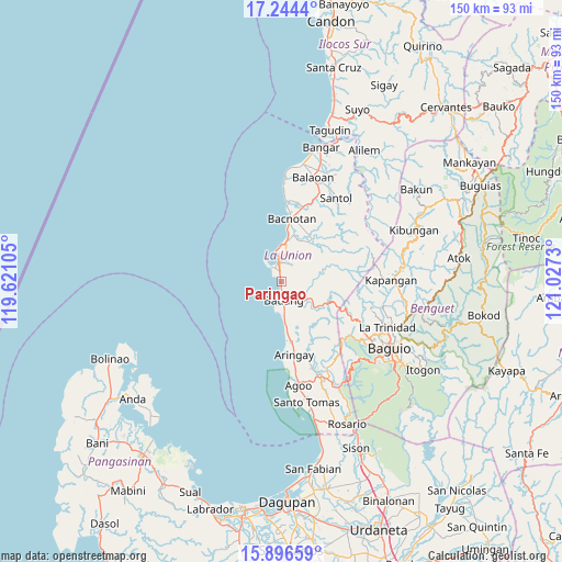
Paringao GPS coordinates[2]
16° 34' 18.012" North, 120° 19' 27.012" East
| Map corner | latitude | longitude |
|---|---|---|
| Upper-left | 17.2444°, | 119.62105° |
| Center: | 16.57167°, | 120.32417° |
| Lower-right: | 15.89659°, | 121.0273° |
| Map W x H: | 149.9×149.9 km | = 93.1×93.1mi |
| max Lat: | 20.78733° ⇑8.7% North |
| Paringao: | 16.57167° |
| min Lat: | ⇓91.3% South 4.65442° |
| min Long | Paringao | max Long |
| 117.04868° | 120.32417° | 126.58417° |
| W 4.9%⇐ | ⇒95.1% E |
Elevation
Elevation of Paringao is 7 m = 23 ft, and this is 80.9 m = 265 ft below average elevation for this country.
| Max E: |
2262 m = 7421 ft | 89.7% |
| Avg. | 87.9 m = 288 ft | |
| Paringao | 7 m = 23 ft | |
Min E: |
-2 m = -7 ft | 10.3% |
See also: Philippines elevation on elevation.city.
Geographical zone
Paringao is located in North Torrid zone (between Equator and Tropic of Cancer). Distance of this Northern Tropic circle is 763.3 km =474.3 mi to North.| Distance of | km | miles | from Paringao |
|---|---|---|---|
| North Pole | 8164.5 | 5073.2 | to North |
| Arctic Circle | 5558.6 | 3454 | to North |
| Tropic Cancer | 763.3 | 474.3 | to North |
| Equator | 1842.6 | 1144.9 | to South |


Nearby cities:
15 places around Paringao: (largest is in red/bold)
• Acao
7.6 km =4.7 mi,  132°
132°
• Aringay
20 km =12.4 mi,  170°
170°
• Bacnotan
17 km =10.6 mi,  10°
10°
• Bagulin
12.9 km =8 mi,  71°
71°
• Bauang
4.6 km =2.9 mi, 168°
• Burgos
15.9 km =9.9 mi,  111°
111°
• Caba
15.7 km =9.8 mi, 172°
• Dagup
14.8 km =9.2 mi,  60°
60°
• Naguilian
8.8 km =5.5 mi,  118°
118°
• Nangalisan
22.4 km =13.9 mi, 132°
• Payocpoc Sur
8.6 km =5.3 mi,  177°
177°
• Sablan
20.2 km =12.6 mi, 115°
• San Fernando
5 km =3.1 mi,  350°
350°
• San Gabriel
14.3 km =8.9 mi,  36°
36°
• San Juan
10.9 km =6.8 mi, 9°
Sources, notices
• [Note1] Compared only with cities in Philippines existing in our database
• [Src1] Map data: © OpenStreetMap contributors (CC-BY-SA)
• [Src2] Other city data from geonames.org with taken over terms of usage.
• [Src3] Geographical zone / Annual Mean Temperature by Robert A. Rohde @ Wikipedia
