Prinza geodata
Prinza (Calabarzon) is a populated place; located in Philippines in Asia/Manila (GMT+8) time zone. With population of 2,907 people, there are 2631 cities with bigger population in this country. Compared to other cities in Philippines, 71.8% of cities are located further ↓South; 72.8% of cities are located further →East and 77.2% of cities have lower elevation than Prinza. Note1
Administrative division(s):
- Level 1: Calabarzon
- Level 2: Province of Laguna
- Level 3: City of Calamba


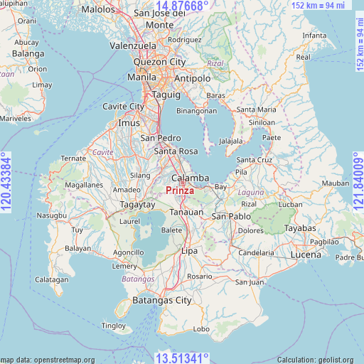
Prinza GPS coordinates[2]
14° 11' 45.852" North, 121° 8' 13.056" East
| Map corner | latitude | longitude |
|---|---|---|
| Upper-left | 14.87668°, | 120.43384° |
| Center: | 14.19607°, | 121.13696° |
| Lower-right: | 13.51341°, | 121.84009° |
| Map W x H: | 151.6×151.6 km | = 94.2×94.2mi |
| max Lat: | 20.78733° ⇑28.2% North |
| Prinza: | 14.19607° |
| min Lat: | ⇓71.8% South 4.65442° |
| min Long | Prinza | max Long |
| 117.04868° | 121.13696° | 126.58417° |
| W 27.2%⇐ | ⇒72.8% E |
Elevation
Elevation of Prinza is 76 m = 249 ft, and this is 11.9 m = 39 ft below average elevation for this country.
| Max E: |
2262 m = 7421 ft | 22.8% |
| Avg. | 87.9 m = 288 ft | |
| Prinza | 76 m = 249 ft | |
Min E: |
-2 m = -7 ft | 77.2% |
See also: Philippines elevation on elevation.city.
Geographical zone
Prinza is located in North Torrid zone (between Equator and Tropic of Cancer). Distance of this Northern Tropic circle is 1027.5 km =638.5 mi to North.| Distance of | km | miles | from Prinza |
|---|---|---|---|
| North Pole | 8428.6 | 5237.3 | to North |
| Arctic Circle | 5822.7 | 3618.1 | to North |
| Tropic Cancer | 1027.5 | 638.5 | to North |
| Equator | 1578.5 | 980.8 | to South |


Nearby cities:
15 places around Prinza: (largest is in red/bold)
• Bilog-Bilog
10.5 km =6.5 mi,  209°
209°
• Bitin
12.7 km =7.9 mi,  134°
134°
• Cabuyao
8.6 km =5.3 mi,  352°
352°
• Calamba
3.5 km =2.2 mi,  60°
60°
• Janopol
13.1 km =8.1 mi,  200°
200°
• Los Baños
11.7 km =7.3 mi,  104°
104°
• Mamatid
4.9 km =3 mi,  28°
28°
• Pantay Na Matanda
8.9 km =5.5 mi,  191°
191°
• Pulong Santa Cruz
10.8 km =6.7 mi,  322°
322°
• Puting Kahoy
11.6 km =7.2 mi,  280°
280°
• Santa Rosa
13.2 km =8.2 mi, 347°
• Santo Tomas
9.8 km =6.1 mi,  177°
177°
• Santor
11.6 km =7.2 mi, 195°
• Tanauan
12.3 km =7.6 mi,  173°
173°
• Tranca
12.2 km =7.6 mi,  224°
224°
Sources, notices
• [Note1] Compared only with cities in Philippines existing in our database
• [Src1] Map data: © OpenStreetMap contributors (CC-BY-SA)
• [Src2] Other city data from geonames.org with taken over terms of usage.
• [Src3] Geographical zone / Annual Mean Temperature by Robert A. Rohde @ Wikipedia
