Mamatid geodata
Mamatid (Calabarzon) is a populated place; located in Philippines in Asia/Manila (GMT+8) time zone. With population of 40,271 people, there are 215 cities with bigger population in this country. Compared to other cities in Philippines, 72.3% of cities are located further ↓South; 72.3% of cities are located further →East and 65.1% of cities have higher elevation than Mamatid. Note1


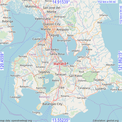
Mamatid GPS coordinates[2]
14° 14' 5.64" North, 121° 9' 32.472" East
| Map corner | latitude | longitude |
|---|---|---|
| Upper-left | 14.91539°, | 120.4559° |
| Center: | 14.2349°, | 121.15902° |
| Lower-right: | 13.55235°, | 121.86215° |
| Map W x H: | 151.6×151.6 km | = 94.2×94.2mi |
| max Lat: | 20.78733° ⇑27.7% North |
| Mamatid: | 14.2349° |
| min Lat: | ⇓72.3% South 4.65442° |
| min Long | Mamatid | max Long |
| 117.04868° | 121.15902° | 126.58417° |
| W 27.7%⇐ | ⇒72.3% E |
Elevation
Elevation of Mamatid is 14 m = 46 ft, and this is 73.9 m = 242 ft below average elevation for this country.
| Max E: |
2262 m = 7421 ft | 65.1% |
| Avg. | 87.9 m = 288 ft | |
| Mamatid | 14 m = 46 ft | |
Min E: |
-2 m = -7 ft | 34.9% |
See also: Mamatid elevation on elevation.city.
Geographical zone
Mamatid is located in North Torrid zone (between Equator and Tropic of Cancer). Distance of this Northern Tropic circle is 1023.1 km =635.7 mi to North.| Distance of | km | miles | from Mamatid |
|---|---|---|---|
| North Pole | 8424.3 | 5234.6 | to North |
| Arctic Circle | 5818.4 | 3615.4 | to North |
| Tropic Cancer | 1023.1 | 635.7 | to North |
| Equator | 1582.8 | 983.5 | to South |


Nearby cities:
15 places around Mamatid: (largest is in red/bold)
• Aplaya
10.8 km =6.7 mi,  332°
332°
• Bay
14.8 km =9.2 mi,  112°
112°
• Bitin
14.8 km =9.2 mi,  152°
152°
• Biñan
14.7 km =9.1 mi,  324°
324°
• Cabuyao
5.5 km =3.4 mi, 319°
• Calamba
2.7 km =1.7 mi,  165°
165°
• Carmona
14 km =8.7 mi,  308°
308°
• Gulod
13.8 km =8.6 mi,  27°
27°
• Los Baños
11.5 km =7.1 mi,  128°
128°
• Pantay Na Matanda
13.7 km =8.5 mi,  197°
197°
• Prinza
4.9 km =3 mi,  208°
208°
• Pulong Santa Cruz
9.9 km =6.2 mi,  295°
295°
• Puting Kahoy
14 km =8.7 mi,  261°
261°
• Santa Rosa
10 km =6.2 mi, 329°
• Santo Tomas
14.2 km =8.8 mi,  187°
187°
Sources, notices
• [Note1] Compared only with cities in Philippines existing in our database
• [Src1] Map data: © OpenStreetMap contributors (CC-BY-SA)
• [Src2] Other city data from geonames.org with taken over terms of usage.
• [Src3] Geographical zone / Annual Mean Temperature by Robert A. Rohde @ Wikipedia
