Pau geodata
Pau (Central Luzon) is a populated place; located in Philippines in Asia/Manila (GMT+8) time zone. With population of 2,428 people, there are 3415 cities with bigger population in this country. Compared to other cities in Philippines, 77.9% of cities are located further ↓South; 84.2% of cities are located further →East and 89.7% of cities have higher elevation than Pau. Note1
Administrative division(s):
- Level 1: Central Luzon
- Level 2: Province of Pampanga
- Level 3: City of San Fernando


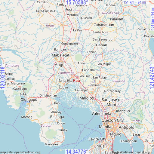
Pau GPS coordinates[2]
15° 1' 40.44" North, 120° 43' 27.48" East
| Map corner | latitude | longitude |
|---|---|---|
| Upper-left | 15.70588°, | 120.02118° |
| Center: | 15.0279°, | 120.7243° |
| Lower-right: | 14.34776°, | 121.42743° |
| Map W x H: | 151×151 km | = 93.8×93.8mi |
| max Lat: | 20.78733° ⇑22.1% North |
| Pau: | 15.0279° |
| min Lat: | ⇓77.9% South 4.65442° |
| min Long | Pau | max Long |
| 117.04868° | 120.7243° | 126.58417° |
| W 15.8%⇐ | ⇒84.2% E |
Elevation
Elevation of Pau is 7 m = 23 ft, and this is 80.9 m = 265 ft below average elevation for this country.
| Max E: |
2262 m = 7421 ft | 89.7% |
| Avg. | 87.9 m = 288 ft | |
| Pau | 7 m = 23 ft | |
Min E: |
-2 m = -7 ft | 10.3% |
See also: Philippines elevation on elevation.city.
Geographical zone
Pau is located in North Torrid zone (between Equator and Tropic of Cancer). Distance of this Northern Tropic circle is 935 km =581 mi to North.| Distance of | km | miles | from Pau |
|---|---|---|---|
| North Pole | 8336.1 | 5179.8 | to North |
| Arctic Circle | 5730.2 | 3560.6 | to North |
| Tropic Cancer | 935 | 581 | to North |
| Equator | 1670.9 | 1038.2 | to South |


Nearby cities:
15 places around Pau: (largest is in red/bold)
• Del Pilar
2.8 km =1.7 mi,  288°
288°
• Laug
3.6 km =2.2 mi,  54°
54°
• Lourdes
8.1 km =5 mi,  212°
212°
• Magliman
6.5 km =4 mi,  277°
277°
• Mexico
4.1 km =2.5 mi,  353°
353°
• San Carlos
4.3 km =2.7 mi,  72°
72°
• San Fernando
4.3 km =2.7 mi, 279°
• San Jose
6.4 km =4 mi,  84°
84°
• San Juan
5.1 km =3.2 mi,  263°
263°
• San Luis
7 km =4.3 mi, 78°
• San Nicolas
7.7 km =4.8 mi, 78°
• San Patricio
7.8 km =4.8 mi,  3°
3°
• San Simon
6.8 km =4.2 mi,  117°
117°
• Santo Domingo
4.6 km =2.9 mi,  153°
153°
• Santo Domingo
6.1 km =3.8 mi,  35°
35°
Sources, notices
• [Note1] Compared only with cities in Philippines existing in our database
• [Src1] Map data: © OpenStreetMap contributors (CC-BY-SA)
• [Src2] Other city data from geonames.org with taken over terms of usage.
• [Src3] Geographical zone / Annual Mean Temperature by Robert A. Rohde @ Wikipedia
