Magliman geodata
Magliman (Central Luzon) is a populated place; located in Philippines in Asia/Manila (GMT+8) time zone. With population of 2,505 people, there are 3274 cities with bigger population in this country. Compared to other cities in Philippines, 78% of cities are located further ↓South; 86% of cities are located further →East and 57.6% of cities have higher elevation than Magliman. Note1
Administrative division(s):
- Level 1: Central Luzon
- Level 2: Province of Pampanga
- Level 3: City of San Fernando


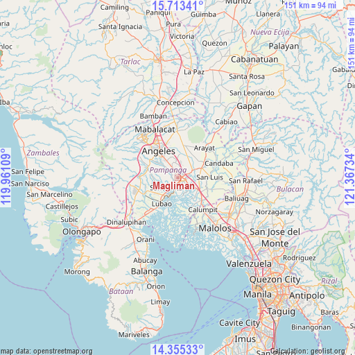
Magliman GPS coordinates[2]
15° 2' 7.62" North, 120° 39' 51.156" East
| Map corner | latitude | longitude |
|---|---|---|
| Upper-left | 15.71341°, | 119.96109° |
| Center: | 15.03545°, | 120.66421° |
| Lower-right: | 14.35533°, | 121.36734° |
| Map W x H: | 151×151 km | = 93.8×93.8mi |
| max Lat: | 20.78733° ⇑22% North |
| Magliman: | 15.03545° |
| min Lat: | ⇓78% South 4.65442° |
| min Long | Magliman | max Long |
| 117.04868° | 120.66421° | 126.58417° |
| W 14%⇐ | ⇒86% E |
Elevation
Elevation of Magliman is 18 m = 59 ft, and this is 69.9 m = 229 ft below average elevation for this country.
| Max E: |
2262 m = 7421 ft | 57.6% |
| Avg. | 87.9 m = 288 ft | |
| Magliman | 18 m = 59 ft | |
Min E: |
-2 m = -7 ft | 42.4% |
See also: Philippines elevation on elevation.city.
Geographical zone
Magliman is located in North Torrid zone (between Equator and Tropic of Cancer). Distance of this Northern Tropic circle is 934.1 km =580.4 mi to North.| Distance of | km | miles | from Magliman |
|---|---|---|---|
| North Pole | 8335.3 | 5179.3 | to North |
| Arctic Circle | 5729.4 | 3560.1 | to North |
| Tropic Cancer | 934.1 | 580.4 | to North |
| Equator | 1671.8 | 1038.8 | to South |


Nearby cities:
15 places around Magliman: (largest is in red/bold)
• Bacolor
4.1 km =2.5 mi,  198°
198°
• Balas
8.5 km =5.3 mi,  280°
280°
• Bulaon
5.2 km =3.2 mi,  358°
358°
• Del Pilar
3.8 km =2.4 mi,  89°
89°
• Guagua
8.5 km =5.3 mi, 203°
• Laug
9.5 km =5.9 mi,  82°
82°
• Lourdes
7.9 km =4.9 mi,  164°
164°
• Mexico
6.8 km =4.2 mi,  61°
61°
• Minalin
7.8 km =4.8 mi,  165°
165°
• Pau
6.5 km =4 mi,  97°
97°
• San Agustin
8 km =5 mi,  231°
231°
• San Basilio
8.6 km =5.3 mi,  268°
268°
• San Fernando
2.2 km =1.4 mi, 93°
• San Juan
2 km =1.2 mi,  134°
134°
• Santa Rita
6.9 km =4.3 mi, 234°
Sources, notices
• [Note1] Compared only with cities in Philippines existing in our database
• [Src1] Map data: © OpenStreetMap contributors (CC-BY-SA)
• [Src2] Other city data from geonames.org with taken over terms of usage.
• [Src3] Geographical zone / Annual Mean Temperature by Robert A. Rohde @ Wikipedia
