Oton geodata
Oton (Western Visayas) is a seat of a third-order administrative division; located in Philippines in Asia/Manila (GMT+8) time zone. With population of 14,395 people, there are 464 cities with bigger population in this country. Compared to other cities in Philippines, 61% of cities are located further ↑North; 55.3% of cities are located further →East and 97.1% of cities have higher elevation than Oton. Note1


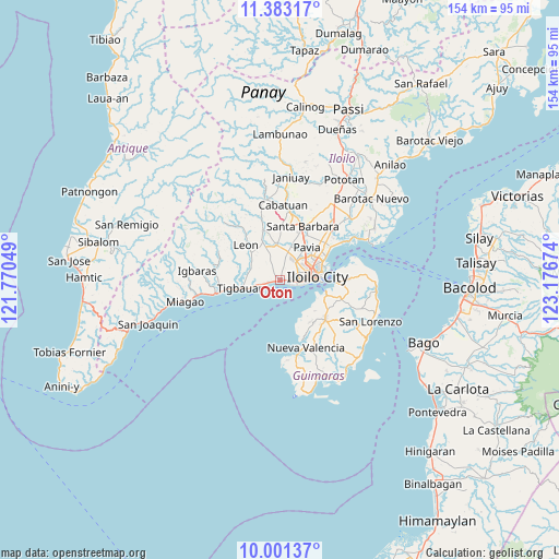
Oton GPS coordinates[2]
10° 41' 35.016" North, 122° 28' 24.996" East
| Map corner | latitude | longitude |
|---|---|---|
| Upper-left | 11.38317°, | 121.77049° |
| Center: | 10.69306°, | 122.47361° |
| Lower-right: | 10.00137°, | 123.17674° |
| Map W x H: | 153.6×153.6 km | = 95.4×95.4mi |
| max Lat: | 20.78733° ⇑61% North |
| Oton: | 10.69306° |
| min Lat: | ⇓39% South 4.65442° |
| min Long | Oton | max Long |
| 117.04868° | 122.47361° | 126.58417° |
| W 44.7%⇐ | ⇒55.3% E |
Elevation
Elevation of Oton is 4 m = 13 ft, and this is 83.9 m = 275 ft below average elevation for this country.
| Max E: |
2262 m = 7421 ft | 97.1% |
| Avg. | 87.9 m = 288 ft | |
| Oton | 4 m = 13 ft | |
Min E: |
-2 m = -7 ft | 2.9% |
See also: Philippines elevation on elevation.city.
Geographical zone
Oton is located in North Torrid zone (between Equator and Tropic of Cancer). Distance of Equator is 1189 km =738.8 mi to South.| Distance of | km | miles | from Oton |
|---|---|---|---|
| North Pole | 8818.1 | 5479.3 | to North |
| Arctic Circle | 6212.2 | 3860.1 | to North |
| Tropic Cancer | 1417 | 880.5 | to North |
| Equator | 1189 | 738.8 | to South |


Nearby cities:
15 places around Oton: (largest is in red/bold)
• Abilay
5.3 km =3.3 mi,  32°
32°
• Atabayan
6.3 km =3.9 mi,  260°
260°
• Balabag
8.1 km =5 mi,  15°
15°
• Buray
2.9 km =1.8 mi,  327°
327°
• Cagbang
2.9 km =1.8 mi,  74°
74°
• Cordova
8.9 km =5.5 mi,  297°
297°
• Iloilo
9.9 km =6.2 mi,  87°
87°
• Jibao-an
10.4 km =6.5 mi, 16°
• Napnapan
9 km =5.6 mi,  280°
280°
• Pakiad
5.9 km =3.7 mi, 68°
• San Miguel
9.7 km =6 mi,  354°
354°
• San Nicolas
2.6 km =1.6 mi,  111°
111°
• Santa Monica
5.3 km =3.3 mi,  335°
335°
• Trapiche
4.6 km =2.9 mi, 257°
• Ungca
10.5 km =6.5 mi,  52°
52°
Sources, notices
• [Note1] Compared only with cities in Philippines existing in our database
• [Src1] Map data: © OpenStreetMap contributors (CC-BY-SA)
• [Src2] Other city data from geonames.org with taken over terms of usage.
• [Src3] Geographical zone / Annual Mean Temperature by Robert A. Rohde @ Wikipedia
