Nagiba geodata
Nagiba (Mimaropa) is a populated place; located in Philippines in Asia/Manila (GMT+8) time zone. With population of 2,370 people, there are 3517 cities with bigger population in this country. Compared to other cities in Philippines, 60.5% of cities are located further ↓South; 70.6% of cities are located further →East and 73.2% of cities have higher elevation than Nagiba. Note1


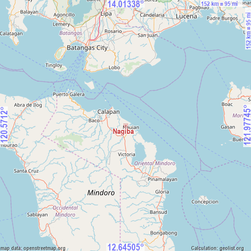
Nagiba GPS coordinates[2]
13° 19' 48.648" North, 121° 16' 27.552" East
| Map corner | latitude | longitude |
|---|---|---|
| Upper-left | 14.01338°, | 120.5712° |
| Center: | 13.33018°, | 121.27432° |
| Lower-right: | 12.64505°, | 121.97745° |
| Map W x H: | 152.1×152.1 km | = 94.5×94.5mi |
| max Lat: | 20.78733° ⇑39.5% North |
| Nagiba: | 13.33018° |
| min Lat: | ⇓60.5% South 4.65442° |
| min Long | Nagiba | max Long |
| 117.04868° | 121.27432° | 126.58417° |
| W 29.4%⇐ | ⇒70.6% E |
Elevation
Elevation of Nagiba is 11 m = 36 ft, and this is 76.9 m = 252 ft below average elevation for this country.
| Max E: |
2262 m = 7421 ft | 73.2% |
| Avg. | 87.9 m = 288 ft | |
| Nagiba | 11 m = 36 ft | |
Min E: |
-2 m = -7 ft | 26.8% |
See also: Philippines elevation on elevation.city.
Geographical zone
Nagiba is located in North Torrid zone (between Equator and Tropic of Cancer). Distance of this Northern Tropic circle is 1123.7 km =698.2 mi to North.| Distance of | km | miles | from Nagiba |
|---|---|---|---|
| North Pole | 8524.9 | 5297.1 | to North |
| Arctic Circle | 5919 | 3677.9 | to North |
| Tropic Cancer | 1123.7 | 698.2 | to North |
| Equator | 1482.2 | 921 | to South |


Nearby cities:
15 places around Nagiba: (largest is in red/bold)
• Apitong
12.4 km =7.7 mi,  215°
215°
• Bayanan
11.7 km =7.3 mi,  285°
285°
• Biga
12.5 km =7.8 mi,  259°
259°
• Calapan
13.6 km =8.5 mi,  311°
311°
• Canubing No 2
15.4 km =9.6 mi,  278°
278°
• Communal
17.1 km =10.6 mi,  240°
240°
• Dulangan
17.7 km =11 mi, 260°
• Estrella
4 km =2.5 mi,  91°
91°
• Manogpi
7.9 km =4.9 mi,  254°
254°
• Naujan
3.2 km =2 mi,  103°
103°
• Pinagsabangan
7.2 km =4.5 mi,  185°
185°
• San Agustin
6.7 km =4.2 mi,  150°
150°
• San Vincente
13.7 km =8.5 mi, 308°
• Sapol
10 km =6.2 mi, 292°
• Victoria
17 km =10.6 mi,  178°
178°
Sources, notices
• [Note1] Compared only with cities in Philippines existing in our database
• [Src1] Map data: © OpenStreetMap contributors (CC-BY-SA)
• [Src2] Other city data from geonames.org with taken over terms of usage.
• [Src3] Geographical zone / Annual Mean Temperature by Robert A. Rohde @ Wikipedia
