Mawab geodata
Mawab (Davao) is a seat of a third-order administrative division; located in Philippines in Asia/Manila (GMT+8) time zone. In our database, there are 4166 cities with bigger population. Compared to other cities in Philippines, 86.3% of cities are located further ↑North; 97.6% of cities are located further ←West and 82.5% of cities have lower elevation than Mawab. Note1


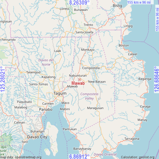
Mawab GPS coordinates[2]
7° 34' 0.012" North, 125° 58' 59.988" East
| Map corner | latitude | longitude |
|---|---|---|
| Upper-left | 8.26309°, | 125.28021° |
| Center: | 7.56667°, | 125.98333° |
| Lower-right: | 6.86912°, | 126.68646° |
| Map W x H: | 155×155 km | = 96.3×96.3mi |
| max Lat: | 20.78733° ⇑86.3% North |
| Mawab: | 7.56667° |
| min Lat: | ⇓13.7% South 4.65442° |
| min Long | Mawab | max Long |
| 117.04868° | 125.98333° | 126.58417° |
| W 97.6%⇐ | ⇒2.4% E |
Elevation
Elevation of Mawab is 111 m = 364 ft, and this is 23.1 m = 76 ft above average elevation for this country.
| Max E: |
2262 m = 7421 ft | 17.5% |
| Mawab | 111 m 364 ft | |
| Avg. | 87.9 m = 288 ft | |
Min E: |
-2 m = -7 ft | 82.5% |
See also: Philippines elevation on elevation.city.
Geographical zone
Mawab is located in North Torrid zone (between Equator and Tropic of Cancer). Distance of Equator is 841.3 km =522.8 mi to South.| Distance of | km | miles | from Mawab |
|---|---|---|---|
| North Pole | 9165.7 | 5695.3 | to North |
| Arctic Circle | 6559.8 | 4076.1 | to North |
| Tropic Cancer | 1764.6 | 1096.5 | to North |
| Equator | 841.3 | 522.8 | to South |


Nearby cities:
15 places around Mawab: (largest is in red/bold)
• Andili
11.7 km =7.3 mi,  187°
187°
• Bantacan
16.7 km =10.4 mi,  75°
75°
• Cabinuangan
14.1 km =8.8 mi,  23°
23°
• Compostela
16.6 km =10.3 mi,  44°
44°
• Del Pilar
17.3 km =10.7 mi,  268°
268°
• Gabi
13.4 km =8.3 mi,  63°
63°
• Linoan
6.7 km =4.2 mi,  351°
351°
• Manat
3.9 km =2.4 mi,  94°
94°
• Manat
5.3 km =3.3 mi,  135°
135°
• Montevista
14.1 km =8.8 mi,  2°
2°
• Nabunturan
4.9 km =3 mi,  337°
337°
• New Bohol
16.9 km =10.5 mi,  253°
253°
• New Corella
17.7 km =11 mi,  277°
277°
• New Sibonga
5.9 km =3.7 mi,  263°
263°
• San Mariano
7.6 km =4.7 mi,  166°
166°
Sources, notices
• [Note1] Compared only with cities in Philippines existing in our database
• [Src1] Map data: © OpenStreetMap contributors (CC-BY-SA)
• [Src2] Other city data from geonames.org with taken over terms of usage.
• [Src3] Geographical zone / Annual Mean Temperature by Robert A. Rohde @ Wikipedia
