Manay geodata
Manay (Davao) is a populated place; located in Philippines in Asia/Manila (GMT+8) time zone. With population of 4,610 people, there are 1442 cities with bigger population in this country. Compared to other cities in Philippines, 88.2% of cities are located further ↑North; 94.3% of cities are located further ←West and 63.6% of cities have lower elevation than Manay. Note1
Administrative division(s):
- Level 1: Davao
- Level 2: Province of Davao del Norte
- Level 3: City of Panabo


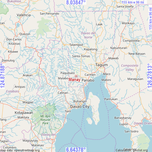
Manay GPS coordinates[2]
7° 20' 30.012" North, 125° 34' 30" East
| Map corner | latitude | longitude |
|---|---|---|
| Upper-left | 8.03847°, | 124.87188° |
| Center: | 7.34167°, | 125.575° |
| Lower-right: | 6.64378°, | 126.27813° |
| Map W x H: | 155.1×155.1 km | = 96.4×96.4mi |
| max Lat: | 20.78733° ⇑88.2% North |
| Manay: | 7.34167° |
| min Lat: | ⇓11.8% South 4.65442° |
| min Long | Manay | max Long |
| 117.04868° | 125.575° | 126.58417° |
| W 94.3%⇐ | ⇒5.7% E |
Elevation
Elevation of Manay is 39 m = 128 ft, and this is 48.9 m = 160 ft below average elevation for this country.
| Max E: |
2262 m = 7421 ft | 36.4% |
| Avg. | 87.9 m = 288 ft | |
| Manay | 39 m = 128 ft | |
Min E: |
-2 m = -7 ft | 63.6% |
See also: Philippines elevation on elevation.city.
Geographical zone
Manay is located in North Torrid zone (between Equator and Tropic of Cancer). Distance of Equator is 816.3 km =507.2 mi to South.| Distance of | km | miles | from Manay |
|---|---|---|---|
| North Pole | 9190.7 | 5710.8 | to North |
| Arctic Circle | 6584.9 | 4091.7 | to North |
| Tropic Cancer | 1789.6 | 1112 | to North |
| Equator | 816.3 | 507.2 | to South |


Nearby cities:
15 places around Manay: (largest is in red/bold)
• Alejal
10.5 km =6.5 mi,  63°
63°
• Anibongan
16.9 km =10.5 mi,  70°
70°
• Carmen
14.6 km =9.1 mi,  81°
81°
• Katipunan
5.5 km =3.4 mi,  115°
115°
• Lasang
12.9 km =8 mi,  129°
129°
• Mabuhay
3.2 km =2 mi,  252°
252°
• Maduao
7.7 km =4.8 mi, 133°
• Magsaysay
9 km =5.6 mi,  47°
47°
• Mahayag
14.7 km =9.1 mi,  160°
160°
• Manaloal
9.8 km =6.1 mi, 73°
• Nanyo
7 km =4.3 mi,  97°
97°
• Panabo
12.6 km =7.8 mi,  107°
107°
• Santo Niño
14.5 km =9 mi, 96°
• Tubod
8.4 km =5.2 mi, 66°
• Tuganay
16.6 km =10.3 mi, 79°
Sources, notices
• [Note1] Compared only with cities in Philippines existing in our database
• [Src1] Map data: © OpenStreetMap contributors (CC-BY-SA)
• [Src2] Other city data from geonames.org with taken over terms of usage.
• [Src3] Geographical zone / Annual Mean Temperature by Robert A. Rohde @ Wikipedia
