Mabahin geodata
Mabahin (Caraga) is a populated place; located in Philippines in Asia/Manila (GMT+8) time zone. With population of 2,327 people, there are 3617 cities with bigger population in this country. Compared to other cities in Philippines, 74.7% of cities are located further ↑North; 98.9% of cities are located further ←West and 54.5% of cities have higher elevation than Mabahin. Note1


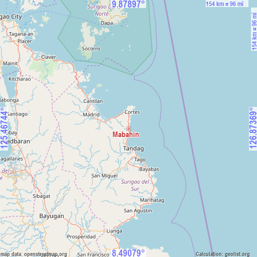
Mabahin GPS coordinates[2]
9° 11' 8.016" North, 126° 10' 14.016" East
| Map corner | latitude | longitude |
|---|---|---|
| Upper-left | 9.87897°, | 125.46744° |
| Center: | 9.18556°, | 126.17056° |
| Lower-right: | 8.49079°, | 126.87369° |
| Map W x H: | 154.4×154.4 km | = 95.9×95.9mi |
| max Lat: | 20.78733° ⇑74.7% North |
| Mabahin: | 9.18556° |
| min Lat: | ⇓25.3% South 4.65442° |
| min Long | Mabahin | max Long |
| 117.04868° | 126.17056° | 126.58417° |
| W 98.9%⇐ | ⇒1.1% E |
Elevation
Elevation of Mabahin is 20 m = 66 ft, and this is 67.9 m = 223 ft below average elevation for this country.
| Max E: |
2262 m = 7421 ft | 54.5% |
| Avg. | 87.9 m = 288 ft | |
| Mabahin | 20 m = 66 ft | |
Min E: |
-2 m = -7 ft | 45.5% |
See also: Philippines elevation on elevation.city.
Geographical zone
Mabahin is located in North Torrid zone (between Equator and Tropic of Cancer). Distance of Equator is 1021.3 km =634.6 mi to South.| Distance of | km | miles | from Mabahin |
|---|---|---|---|
| North Pole | 8985.7 | 5583.5 | to North |
| Arctic Circle | 6379.8 | 3964.2 | to North |
| Tropic Cancer | 1584.6 | 984.6 | to North |
| Equator | 1021.3 | 634.6 | to South |


Nearby cities:
15 places around Mabahin: (largest is in red/bold)
• Bayabas
27.1 km =16.8 mi,  152°
152°
• Buenavista
7.9 km =4.9 mi,  187°
187°
• Burgos
9.2 km =5.7 mi,  12°
12°
• Cantilan
26.8 km =16.7 mi,  307°
307°
• Carmen
17.4 km =10.8 mi,  285°
285°
• Cortes
10.7 km =6.6 mi, 12°
• Gamut
20.1 km =12.5 mi,  180°
180°
• La Paz
24.5 km =15.2 mi,  155°
155°
• Lanuza
12.8 km =8 mi, 294°
• Madrid
24.2 km =15 mi, 290°
• Panikian
30.5 km =19 mi,  301°
301°
• Parang
27.2 km =16.9 mi, 293°
• Tago
19.5 km =12.1 mi, 159°
• Tandag
12.3 km =7.6 mi,  165°
165°
• Tigao
2.7 km =1.7 mi, 13°
Sources, notices
• [Note1] Compared only with cities in Philippines existing in our database
• [Src1] Map data: © OpenStreetMap contributors (CC-BY-SA)
• [Src2] Other city data from geonames.org with taken over terms of usage.
• [Src3] Geographical zone / Annual Mean Temperature by Robert A. Rohde @ Wikipedia
