Cantilan geodata
Cantilan (Caraga) is a seat of a third-order administrative division; located in Philippines in Asia/Manila (GMT+8) time zone. With population of 9,408 people, there are 656 cities with bigger population in this country. Compared to other cities in Philippines, 73.9% of cities are located further ↑North; 97.5% of cities are located further ←West and 89.7% of cities have higher elevation than Cantilan. Note1


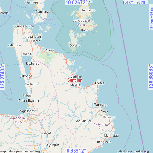
Cantilan GPS coordinates[2]
9° 20' 0.996" North, 125° 58' 39" East
| Map corner | latitude | longitude |
|---|---|---|
| Upper-left | 10.02672°, | 125.27438° |
| Center: | 9.33361°, | 125.9775° |
| Lower-right: | 8.63912°, | 126.68063° |
| Map W x H: | 154.3×154.3 km | = 95.9×95.9mi |
| max Lat: | 20.78733° ⇑73.9% North |
| Cantilan: | 9.33361° |
| min Lat: | ⇓26.1% South 4.65442° |
| min Long | Cantilan | max Long |
| 117.04868° | 125.9775° | 126.58417° |
| W 97.5%⇐ | ⇒2.5% E |
Elevation
Elevation of Cantilan is 7 m = 23 ft, and this is 80.9 m = 265 ft below average elevation for this country.
| Max E: |
2262 m = 7421 ft | 89.7% |
| Avg. | 87.9 m = 288 ft | |
| Cantilan | 7 m = 23 ft | |
Min E: |
-2 m = -7 ft | 10.3% |
See also: Philippines elevation on elevation.city.
Geographical zone
Cantilan is located in North Torrid zone (between Equator and Tropic of Cancer). Distance of Equator is 1037.8 km =644.9 mi to South.| Distance of | km | miles | from Cantilan |
|---|---|---|---|
| North Pole | 8969.3 | 5573.3 | to North |
| Arctic Circle | 6363.4 | 3954 | to North |
| Tropic Cancer | 1568.1 | 974.4 | to North |
| Equator | 1037.8 | 644.9 | to South |


Nearby cities:
15 places around Cantilan: (largest is in red/bold)
• Adlay
12.2 km =7.6 mi,  313°
313°
• Buenavista
31.6 km =19.6 mi,  140°
140°
• Burgos
24.3 km =15.1 mi,  107°
107°
• Carmen
12.7 km =7.9 mi,  159°
159°
• Carrascal
5.1 km =3.2 mi,  322°
322°
• Claver
37.7 km =23.4 mi, 314°
• Cortes
24.2 km =15 mi,  104°
104°
• Lanuza
14.6 km =9.1 mi, 139°
• Mabahin
26.8 km =16.7 mi,  127°
127°
• Madrid
8.1 km =5 mi,  190°
190°
• Panikian
4.8 km =3 mi,  264°
264°
• Parang
7 km =4.3 mi,  213°
213°
• Socorro
32 km =19.9 mi,  357°
357°
• Tandag
37.3 km =23.2 mi, 139°
• Tigao
25.8 km =16 mi,  122°
122°
Sources, notices
• [Note1] Compared only with cities in Philippines existing in our database
• [Src1] Map data: © OpenStreetMap contributors (CC-BY-SA)
• [Src2] Other city data from geonames.org with taken over terms of usage.
• [Src3] Geographical zone / Annual Mean Temperature by Robert A. Rohde @ Wikipedia
