Parang geodata
Parang (Caraga) is a populated place; located in Philippines in Asia/Manila (GMT+8) time zone. With population of 3,491 people, there are 2060 cities with bigger population in this country. Compared to other cities in Philippines, 74% of cities are located further ↑North; 97.3% of cities are located further ←West and 56.1% of cities have higher elevation than Parang. Note1


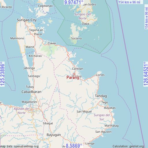
Parang GPS coordinates[2]
9° 16' 53.364" North, 125° 56' 31.488" East
| Map corner | latitude | longitude |
|---|---|---|
| Upper-left | 9.97471°, | 125.23896° |
| Center: | 9.28149°, | 125.94208° |
| Lower-right: | 8.5869°, | 126.64521° |
| Map W x H: | 154.3×154.3 km | = 95.9×95.9mi |
| max Lat: | 20.78733° ⇑74% North |
| Parang: | 9.28149° |
| min Lat: | ⇓26% South 4.65442° |
| min Long | Parang | max Long |
| 117.04868° | 125.94208° | 126.58417° |
| W 97.3%⇐ | ⇒2.7% E |
Elevation
Elevation of Parang is 19 m = 62 ft, and this is 68.9 m = 226 ft below average elevation for this country.
| Max E: |
2262 m = 7421 ft | 56.1% |
| Avg. | 87.9 m = 288 ft | |
| Parang | 19 m = 62 ft | |
Min E: |
-2 m = -7 ft | 43.9% |
See also: Philippines elevation on elevation.city.
Geographical zone
Parang is located in North Torrid zone (between Equator and Tropic of Cancer). Distance of Equator is 1032 km =641.3 mi to South.| Distance of | km | miles | from Parang |
|---|---|---|---|
| North Pole | 8975.1 | 5576.9 | to North |
| Arctic Circle | 6369.2 | 3957.6 | to North |
| Tropic Cancer | 1573.9 | 978 | to North |
| Equator | 1032 | 641.3 | to South |


Nearby cities:
15 places around Parang: (largest is in red/bold)
• Adlay
15.1 km =9.4 mi,  341°
341°
• Buenavista
30.3 km =18.8 mi,  127°
127°
• Burgos
27.1 km =16.8 mi,  93°
93°
• Cantilan
7 km =4.3 mi,  33°
33°
• Carmen
10.3 km =6.4 mi, 126°
• Carrascal
9.9 km =6.2 mi,  4°
4°
• Cortes
27.3 km =17 mi, 90°
• Lanuza
14.4 km =8.9 mi,  111°
111°
• Mabahin
27.2 km =16.9 mi, 113°
• Madrid
3.3 km =2.1 mi, 131°
• Panikian
5.4 km =3.4 mi,  350°
350°
• San Miguel
34.8 km =21.6 mi,  179°
179°
• Socorro
37.9 km =23.5 mi, 4°
• Tandag
36.1 km =22.4 mi, 128°
• Tigao
26.9 km =16.7 mi, 107°
Sources, notices
• [Note1] Compared only with cities in Philippines existing in our database
• [Src1] Map data: © OpenStreetMap contributors (CC-BY-SA)
• [Src2] Other city data from geonames.org with taken over terms of usage.
• [Src3] Geographical zone / Annual Mean Temperature by Robert A. Rohde @ Wikipedia
