Sablig geodata
Sablig (Ilocos) is a populated place; located in Philippines in Asia/Manila (GMT+8) time zone. With population of 2,482 people, there are 3324 cities with bigger population in this country. Compared to other cities in Philippines, 89.7% of cities are located further ↓South; 97.2% of cities are located further →East and 53.1% of cities have higher elevation than Sablig. Note1


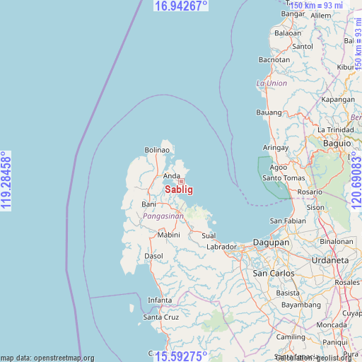
Sablig GPS coordinates[2]
16° 16' 7.932" North, 119° 59' 15.72" East
| Map corner | latitude | longitude |
|---|---|---|
| Upper-left | 16.94267°, | 119.28458° |
| Center: | 16.26887°, | 119.9877° |
| Lower-right: | 15.59275°, | 120.69083° |
| Map W x H: | 150.1×150.1 km | = 93.3×93.3mi |
| max Lat: | 20.78733° ⇑10.3% North |
| Sablig: | 16.26887° |
| min Lat: | ⇓89.7% South 4.65442° |
| min Long | Sablig | max Long |
| 117.04868° | 119.9877° | 126.58417° |
| W 2.8%⇐ | ⇒97.2% E |
Elevation
Elevation of Sablig is 21 m = 69 ft, and this is 66.9 m = 219 ft below average elevation for this country.
| Max E: |
2262 m = 7421 ft | 53.1% |
| Avg. | 87.9 m = 288 ft | |
| Sablig | 21 m = 69 ft | |
Min E: |
-2 m = -7 ft | 46.9% |
See also: Philippines elevation on elevation.city.
Geographical zone
Sablig is located in North Torrid zone (between Equator and Tropic of Cancer). Distance of this Northern Tropic circle is 797 km =495.2 mi to North.| Distance of | km | miles | from Sablig |
|---|---|---|---|
| North Pole | 8198.1 | 5094.1 | to North |
| Arctic Circle | 5592.2 | 3474.8 | to North |
| Tropic Cancer | 797 | 495.2 | to North |
| Equator | 1808.9 | 1124 | to South |


Nearby cities:
15 places around Sablig: (largest is in red/bold)
• Alaminos
12.6 km =7.8 mi,  183°
183°
• Anda
4.6 km =2.9 mi,  299°
299°
• Bani
16.4 km =10.2 mi,  235°
235°
• Banog Sur
15 km =9.3 mi,  219°
219°
• Bued
12.1 km =7.5 mi,  174°
174°
• Cabungan
7.9 km =4.9 mi,  5°
5°
• Carot
8.5 km =5.3 mi,  354°
354°
• Lucap
8.9 km =5.5 mi, 169°
• Pangapisan
6.7 km =4.2 mi,  209°
209°
• Polo
9.1 km =5.7 mi, 207°
• Telbang
13.3 km =8.3 mi,  143°
143°
• Tiep
14 km =8.7 mi,  255°
255°
• Tondol
5.4 km =3.4 mi,  30°
30°
• Toritori
3.5 km =2.2 mi, 166°
• Zaragoza
13.9 km =8.6 mi,  340°
340°
Sources, notices
• [Note1] Compared only with cities in Philippines existing in our database
• [Src1] Map data: © OpenStreetMap contributors (CC-BY-SA)
• [Src2] Other city data from geonames.org with taken over terms of usage.
• [Src3] Geographical zone / Annual Mean Temperature by Robert A. Rohde @ Wikipedia
