Anda geodata
Anda (Ilocos) is a seat of a third-order administrative division; located in Philippines in Asia/Manila (GMT+8) time zone. With population of 3,160 people, there are 2341 cities with bigger population in this country. Compared to other cities in Philippines, 89.7% of cities are located further ↓South; 97.4% of cities are located further →East and 54.4% of cities have lower elevation than Anda. Note1


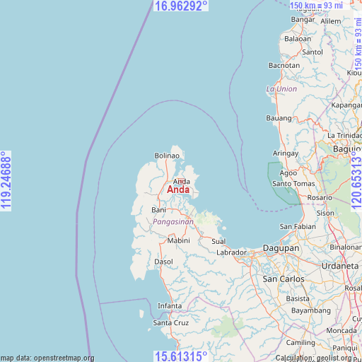
Anda GPS coordinates[2]
16° 17' 21.12" North, 119° 57' 0" East
| Map corner | latitude | longitude |
|---|---|---|
| Upper-left | 16.96292°, | 119.24688° |
| Center: | 16.2892°, | 119.95° |
| Lower-right: | 15.61315°, | 120.65313° |
| Map W x H: | 150.1×150.1 km | = 93.3×93.3mi |
| max Lat: | 20.78733° ⇑10.3% North |
| Anda: | 16.2892° |
| min Lat: | ⇓89.7% South 4.65442° |
| min Long | Anda | max Long |
| 117.04868° | 119.95° | 126.58417° |
| W 2.6%⇐ | ⇒97.4% E |
Elevation
Elevation of Anda is 27 m = 89 ft, and this is 60.9 m = 200 ft below average elevation for this country.
| Max E: |
2262 m = 7421 ft | 45.6% |
| Avg. | 87.9 m = 288 ft | |
| Anda | 27 m = 89 ft | |
Min E: |
-2 m = -7 ft | 54.4% |
See also: Philippines elevation on elevation.city.
Geographical zone
Anda is located in North Torrid zone (between Equator and Tropic of Cancer). Distance of this Northern Tropic circle is 794.7 km =493.8 mi to North.| Distance of | km | miles | from Anda |
|---|---|---|---|
| North Pole | 8195.9 | 5092.7 | to North |
| Arctic Circle | 5590 | 3473.5 | to North |
| Tropic Cancer | 794.7 | 493.8 | to North |
| Equator | 1811.2 | 1125.4 | to South |


Nearby cities:
15 places around Anda: (largest is in red/bold)
• Balingasay
12.5 km =7.8 mi,  307°
307°
• Banog Sur
14.8 km =9.2 mi,  201°
201°
• Binabalian
14.8 km =9.2 mi,  350°
350°
• Bolinao
12.6 km =7.8 mi,  330°
330°
• Cabungan
7.4 km =4.6 mi,  40°
40°
• Carot
7 km =4.3 mi,  27°
27°
• Lucap
12.3 km =7.6 mi,  153°
153°
• Lucero
13.5 km =8.4 mi,  342°
342°
• Pangapisan
8.2 km =5.1 mi,  174°
174°
• Polo
10.3 km =6.4 mi,  180°
180°
• Sablig
4.6 km =2.9 mi,  119°
119°
• Tiep
11.1 km =6.9 mi,  239°
239°
• Tondol
7.1 km =4.4 mi,  70°
70°
• Toritori
7.5 km =4.7 mi,  139°
139°
• Zaragoza
10.9 km =6.8 mi,  356°
356°
Sources, notices
• [Note1] Compared only with cities in Philippines existing in our database
• [Src1] Map data: © OpenStreetMap contributors (CC-BY-SA)
• [Src2] Other city data from geonames.org with taken over terms of usage.
• [Src3] Geographical zone / Annual Mean Temperature by Robert A. Rohde @ Wikipedia
