Lambayong geodata
Lambayong (Soccsksargen) is a populated place; located in Philippines in Asia/Manila (GMT+8) time zone. With population of 11,009 people, there are 562 cities with bigger population in this country. Compared to other cities in Philippines, 95.5% of cities are located further ↑North; 88.5% of cities are located further ←West and 98.4% of cities have lower elevation than Lambayong. Note1
Administrative division(s):
- Level 1: Soccsksargen
- Level 2: Province of South Cotabato
- Level 3: Tampakan


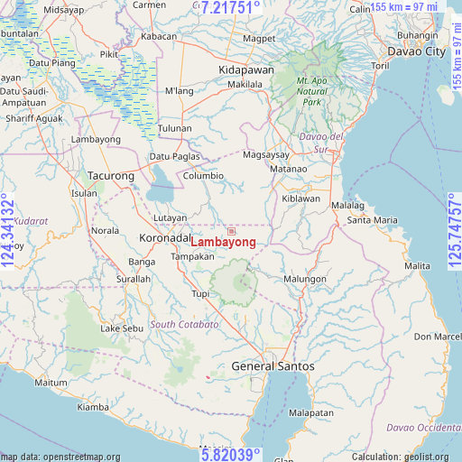
Lambayong GPS coordinates[2]
6° 31' 9.984" North, 125° 2' 39.984" East
| Map corner | latitude | longitude |
|---|---|---|
| Upper-left | 7.21751°, | 124.34132° |
| Center: | 6.51944°, | 125.04444° |
| Lower-right: | 5.82039°, | 125.74757° |
| Map W x H: | 155.3×155.3 km | = 96.5×96.5mi |
| max Lat: | 20.78733° ⇑95.5% North |
| Lambayong: | 6.51944° |
| min Lat: | ⇓4.5% South 4.65442° |
| min Long | Lambayong | max Long |
| 117.04868° | 125.04444° | 126.58417° |
| W 88.5%⇐ | ⇒11.5% E |
Elevation
Elevation of Lambayong is 810 m = 2657 ft, and this is 722.1 m = 2369 ft above average elevation for this country.
| Max E: |
2262 m = 7421 ft | 1.6% |
| Lambayong | 810 m 2657 ft | |
| Avg. | 87.9 m = 288 ft | |
Min E: |
-2 m = -7 ft | 98.4% |
See also: Philippines elevation on elevation.city.
Geographical zone
Lambayong is located in North Torrid zone (between Equator and Tropic of Cancer). Distance of Equator is 724.9 km =450.4 mi to South.| Distance of | km | miles | from Lambayong |
|---|---|---|---|
| North Pole | 9282.2 | 5767.7 | to North |
| Arctic Circle | 6676.3 | 4148.5 | to North |
| Tropic Cancer | 1881 | 1168.8 | to North |
| Equator | 724.9 | 450.4 | to South |


Nearby cities:
15 places around Lambayong: (largest is in red/bold)
• Blingkong
18.7 km =11.6 mi,  294°
294°
• Carpenter Hill
19.9 km =12.4 mi,  245°
245°
• Cebuano
16.9 km =10.5 mi,  209°
209°
• Kipalbig
17.8 km =11.1 mi,  227°
227°
• Lampitak
9.7 km =6 mi,  174°
174°
• Liberty
9.9 km =6.2 mi,  223°
223°
• Linan
12.3 km =7.6 mi, 217°
• Lutayan
21.1 km =13.1 mi,  301°
301°
• Mabini
15.1 km =9.4 mi,  264°
264°
• Maltana
16 km =9.9 mi, 227°
• Palian
21.9 km =13.6 mi, 222°
• Rotonda
17.8 km =11.1 mi, 260°
• Tamnag
19.1 km =11.9 mi, 288°
• Tampakan
5.3 km =3.3 mi,  127°
127°
• Telafas
14.6 km =9.1 mi,  327°
327°
Sources, notices
• [Note1] Compared only with cities in Philippines existing in our database
• [Src1] Map data: © OpenStreetMap contributors (CC-BY-SA)
• [Src2] Other city data from geonames.org with taken over terms of usage.
• [Src3] Geographical zone / Annual Mean Temperature by Robert A. Rohde @ Wikipedia
