Dalipuga geodata
Dalipuga (Northern Mindanao) is a populated place; located in Philippines in Asia/Manila (GMT+8) time zone. With population of 14,242 people, there are 467 cities with bigger population in this country. Compared to other cities in Philippines, 79.9% of cities are located further ↑North; 74.6% of cities are located further ←West and 64.7% of cities have lower elevation than Dalipuga. Note1
Administrative division(s):
- Level 1: Northern Mindanao
- Level 2: Province of Lanao del Norte
- Level 3: Iligan City


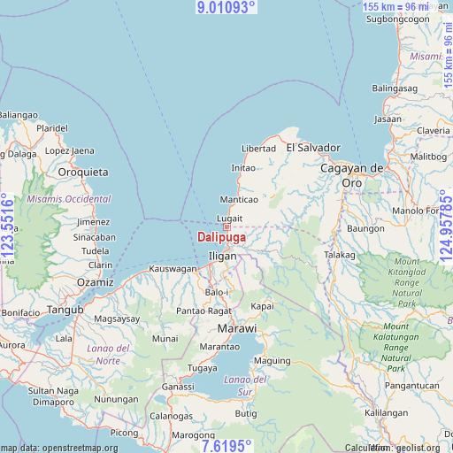
Dalipuga GPS coordinates[2]
8° 18' 56.988" North, 124° 15' 16.992" East
| Map corner | latitude | longitude |
|---|---|---|
| Upper-left | 9.01093°, | 123.5516° |
| Center: | 8.31583°, | 124.25472° |
| Lower-right: | 7.6195°, | 124.95785° |
| Map W x H: | 154.7×154.7 km | = 96.1×96.1mi |
| max Lat: | 20.78733° ⇑79.9% North |
| Dalipuga: | 8.31583° |
| min Lat: | ⇓20.1% South 4.65442° |
| min Long | Dalipuga | max Long |
| 117.04868° | 124.25472° | 126.58417° |
| W 74.6%⇐ | ⇒25.4% E |
Elevation
Elevation of Dalipuga is 41 m = 135 ft, and this is 46.9 m = 154 ft below average elevation for this country.
| Max E: |
2262 m = 7421 ft | 35.3% |
| Avg. | 87.9 m = 288 ft | |
| Dalipuga | 41 m = 135 ft | |
Min E: |
-2 m = -7 ft | 64.7% |
See also: Philippines elevation on elevation.city.
Geographical zone
Dalipuga is located in North Torrid zone (between Equator and Tropic of Cancer). Distance of Equator is 924.6 km =574.5 mi to South.| Distance of | km | miles | from Dalipuga |
|---|---|---|---|
| North Pole | 9082.4 | 5643.5 | to North |
| Arctic Circle | 6476.5 | 4024.3 | to North |
| Tropic Cancer | 1681.3 | 1044.7 | to North |
| Equator | 924.6 | 574.5 | to South |


Nearby cities:
15 places around Dalipuga: (largest is in red/bold)
• Biga
4.7 km =2.9 mi,  6°
6°
• Buawan
5.3 km =3.3 mi,  88°
88°
• Digkilaan
10 km =6.2 mi,  136°
136°
• Iligan
9.7 km =6 mi,  187°
187°
• Kabalantian
10.1 km =6.3 mi,  52°
52°
• Libertad
7.7 km =4.8 mi,  197°
197°
• Lugait
2.9 km =1.8 mi, 9°
• Mantampay
17.1 km =10.6 mi, 194°
• Manticao
10.4 km =6.5 mi,  19°
19°
• Maputi
15.4 km =9.6 mi, 14°
• Mat-i
13.8 km =8.6 mi, 46°
• Naawan
13.7 km =8.5 mi, 15°
• Punta Silum
7.5 km =4.7 mi, 12°
• Rogongon
12.6 km =7.8 mi, 136°
• Tuod
11.4 km =7.1 mi,  74°
74°
Sources, notices
• [Note1] Compared only with cities in Philippines existing in our database
• [Src1] Map data: © OpenStreetMap contributors (CC-BY-SA)
• [Src2] Other city data from geonames.org with taken over terms of usage.
• [Src3] Geographical zone / Annual Mean Temperature by Robert A. Rohde @ Wikipedia
