Carranglan geodata
Carranglan (Central Luzon) is a populated place; located in Philippines in Asia/Manila (GMT+8) time zone. With population of 11,017 people, there are 561 cities with bigger population in this country. Compared to other cities in Philippines, 86.9% of cities are located further ↓South; 74.7% of cities are located further →East and 90.8% of cities have lower elevation than Carranglan. Note1
Administrative division(s):
- Level 1: Central Luzon
- Level 2: Province of Nueva Ecija
- Level 3: Carranglan


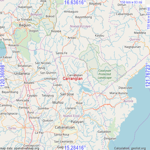
Carranglan GPS coordinates[2]
15° 57' 40.68" North, 121° 3' 50.76" East
| Map corner | latitude | longitude |
|---|---|---|
| Upper-left | 16.63616°, | 120.36098° |
| Center: | 15.9613°, | 121.0641° |
| Lower-right: | 15.28416°, | 121.76723° |
| Map W x H: | 150.3×150.3 km | = 93.4×93.4mi |
| max Lat: | 20.78733° ⇑13.1% North |
| Carranglan: | 15.9613° |
| min Lat: | ⇓86.9% South 4.65442° |
| min Long | Carranglan | max Long |
| 117.04868° | 121.0641° | 126.58417° |
| W 25.3%⇐ | ⇒74.7% E |
Elevation
Elevation of Carranglan is 247 m = 810 ft, and this is 159.1 m = 522 ft above average elevation for this country.
| Max E: |
2262 m = 7421 ft | 9.2% |
| Carranglan | 247 m 810 ft | |
| Avg. | 87.9 m = 288 ft | |
Min E: |
-2 m = -7 ft | 90.8% |
See also: Philippines elevation on elevation.city.
Geographical zone
Carranglan is located in North Torrid zone (between Equator and Tropic of Cancer). Distance of this Northern Tropic circle is 831.2 km =516.5 mi to North.| Distance of | km | miles | from Carranglan |
|---|---|---|---|
| North Pole | 8232.3 | 5115.3 | to North |
| Arctic Circle | 5626.4 | 3496.1 | to North |
| Tropic Cancer | 831.2 | 516.5 | to North |
| Equator | 1774.7 | 1102.7 | to South |


Nearby cities:
15 places around Carranglan: (largest is in red/bold)
• Burgos
12.4 km =7.7 mi,  352°
352°
• Conversion
9.8 km =6.1 mi,  135°
135°
• Digdig
9.3 km =5.8 mi,  261°
261°
• Estrella
23.7 km =14.7 mi,  187°
187°
• Lupao
19.9 km =12.4 mi,  242°
242°
• Nancalobasaan
23.9 km =14.9 mi, 262°
• Pantabangan
18.8 km =11.7 mi,  152°
152°
• Parista
18.8 km =11.7 mi,  230°
230°
• Porais
23 km =14.3 mi, 185°
• Puncan
9.9 km =6.2 mi, 232°
• Salvacion I
20.8 km =12.9 mi, 229°
• Santa Fe
25.8 km =16 mi,  328°
328°
• Santo Tomas
25.9 km =16.1 mi,  204°
204°
• Sibul
19.2 km =11.9 mi, 200°
• Tayabo
14.5 km =9 mi, 194°
Sources, notices
• [Note1] Compared only with cities in Philippines existing in our database
• [Src1] Map data: © OpenStreetMap contributors (CC-BY-SA)
• [Src2] Other city data from geonames.org with taken over terms of usage.
• [Src3] Geographical zone / Annual Mean Temperature by Robert A. Rohde @ Wikipedia
