Cajimos geodata
Cajimos (Mimaropa) is a populated place; located in Philippines in Asia/Manila (GMT+8) time zone. With population of 2,739 people, there are 2882 cities with bigger population in this country. Compared to other cities in Philippines, 55.6% of cities are located further ↓South; 57.4% of cities are located further →East and 50.3% of cities have higher elevation than Cajimos. Note1


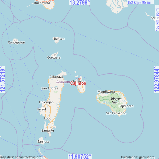
Cajimos GPS coordinates[2]
12° 35' 40.668" North, 122° 16' 31.116" East
| Map corner | latitude | longitude |
|---|---|---|
| Upper-left | 13.2799°, | 121.57219° |
| Center: | 12.59463°, | 122.27531° |
| Lower-right: | 11.90752°, | 122.97844° |
| Map W x H: | 152.6×152.6 km | = 94.8×94.8mi |
| max Lat: | 20.78733° ⇑44.4% North |
| Cajimos: | 12.59463° |
| min Lat: | ⇓55.6% South 4.65442° |
| min Long | Cajimos | max Long |
| 117.04868° | 122.27531° | 126.58417° |
| W 42.6%⇐ | ⇒57.4% E |
Elevation
Elevation of Cajimos is 23 m = 75 ft, and this is 64.9 m = 213 ft below average elevation for this country.
| Max E: |
2262 m = 7421 ft | 50.3% |
| Avg. | 87.9 m = 288 ft | |
| Cajimos | 23 m = 75 ft | |
Min E: |
-2 m = -7 ft | 49.7% |
See also: Philippines elevation on elevation.city.
Geographical zone
Cajimos is located in North Torrid zone (between Equator and Tropic of Cancer). Distance of this Northern Tropic circle is 1205.5 km =749.1 mi to North.| Distance of | km | miles | from Cajimos |
|---|---|---|---|
| North Pole | 8606.7 | 5348 | to North |
| Arctic Circle | 6000.8 | 3728.7 | to North |
| Tropic Cancer | 1205.5 | 749.1 | to North |
| Equator | 1400.4 | 870.2 | to South |


Nearby cities:
15 places around Cajimos: (largest is in red/bold)
• Alad
3.9 km =2.4 mi,  309°
309°
• Calatrava
22.3 km =13.9 mi,  277°
277°
• Carmen
16.9 km =10.5 mi, 278°
• Concepcion
29.5 km =18.3 mi,  221°
221°
• Corcuera
32.3 km =20.1 mi, 310°
• Dobdoban
17.7 km =11 mi,  262°
262°
• España
33.7 km =20.9 mi,  133°
133°
• Libertad
32.9 km =20.4 mi,  241°
241°
• Magdiwang
28.8 km =17.9 mi,  115°
115°
• Panique
31 km =19.3 mi,  245°
245°
• Pato-o
29.1 km =18.1 mi,  231°
231°
• Romblon
2.2 km =1.4 mi,  192°
192°
• San Agustin
15.9 km =9.9 mi, 259°
• Tampayan
30.1 km =18.7 mi,  111°
111°
• Tomingad
32.3 km =20.1 mi, 238°
Sources, notices
• [Note1] Compared only with cities in Philippines existing in our database
• [Src1] Map data: © OpenStreetMap contributors (CC-BY-SA)
• [Src2] Other city data from geonames.org with taken over terms of usage.
• [Src3] Geographical zone / Annual Mean Temperature by Robert A. Rohde @ Wikipedia
