Bamban geodata
Bamban (Central Luzon) is a seat of a third-order administrative division; located in Philippines in Asia/Manila (GMT+8) time zone. With population of 2,511 people, there are 3264 cities with bigger population in this country. Compared to other cities in Philippines, 83.6% of cities are located further ↓South; 95% of cities are located further →East and 76% of cities have lower elevation than Bamban. Note1
Administrative division(s):
- Level 1: Central Luzon
- Level 2: Province of Tarlac
- Level 3: San Clemente


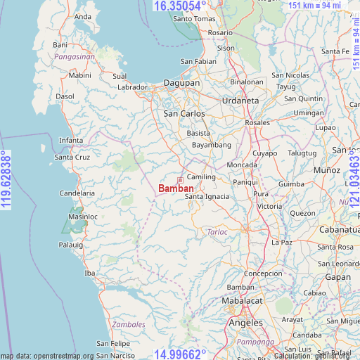
Bamban GPS coordinates[2]
15° 40' 28.92" North, 120° 19' 53.4" East
| Map corner | latitude | longitude |
|---|---|---|
| Upper-left | 16.35054°, | 119.62838° |
| Center: | 15.6747°, | 120.3315° |
| Lower-right: | 14.99662°, | 121.03463° |
| Map W x H: | 150.5×150.5 km | = 93.5×93.5mi |
| max Lat: | 20.78733° ⇑16.4% North |
| Bamban: | 15.6747° |
| min Lat: | ⇓83.6% South 4.65442° |
| min Long | Bamban | max Long |
| 117.04868° | 120.3315° | 126.58417° |
| W 5%⇐ | ⇒95% E |
Elevation
Elevation of Bamban is 72 m = 236 ft, and this is 15.9 m = 52 ft below average elevation for this country.
| Max E: |
2262 m = 7421 ft | 24% |
| Avg. | 87.9 m = 288 ft | |
| Bamban | 72 m = 236 ft | |
Min E: |
-2 m = -7 ft | 76% |
See also: Philippines elevation on elevation.city.
Geographical zone
Bamban is located in North Torrid zone (between Equator and Tropic of Cancer). Distance of this Northern Tropic circle is 863.1 km =536.3 mi to North.| Distance of | km | miles | from Bamban |
|---|---|---|---|
| North Pole | 8264.2 | 5135.1 | to North |
| Arctic Circle | 5658.3 | 3515.9 | to North |
| Tropic Cancer | 863.1 | 536.3 | to North |
| Equator | 1742.9 | 1083 | to South |


Nearby cities:
15 places around Bamban: (largest is in red/bold)
• Bacabac
11.7 km =7.3 mi,  61°
61°
• Bacsay
6.1 km =3.8 mi,  168°
168°
• Bilad
12.9 km =8 mi, 57°
• Bobon Second
5.7 km =3.5 mi,  110°
110°
• Bogtong
9 km =5.6 mi,  358°
358°
• Camiling
8.8 km =5.5 mi,  81°
81°
• Malacampa
9.2 km =5.7 mi, 112°
• Mamonit
12 km =7.5 mi,  144°
144°
• Mangatarem
13.2 km =8.2 mi,  341°
341°
• Mayantoc
7.8 km =4.8 mi, 141°
• San Clemente
5.1 km =3.2 mi,  35°
35°
• San Francisco
12.3 km =7.6 mi, 114°
• Santa Ignacia
12.9 km =8 mi,  119°
119°
• Santa Maria
10.7 km =6.6 mi, 108°
• Tocok
9 km =5.6 mi, 338°
Sources, notices
• [Note1] Compared only with cities in Philippines existing in our database
• [Src1] Map data: © OpenStreetMap contributors (CC-BY-SA)
• [Src2] Other city data from geonames.org with taken over terms of usage.
• [Src3] Geographical zone / Annual Mean Temperature by Robert A. Rohde @ Wikipedia
