Balingasay geodata
Balingasay (Ilocos) is a populated place; located in Philippines in Asia/Manila (GMT+8) time zone. With population of 3,720 people, there are 1906 cities with bigger population in this country. Compared to other cities in Philippines, 90.3% of cities are located further ↓South; 98.2% of cities are located further →East and 76.6% of cities have higher elevation than Balingasay. Note1


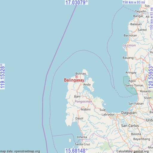
Balingasay GPS coordinates[2]
16° 21' 26.28" North, 119° 51' 23.04" East
| Map corner | latitude | longitude |
|---|---|---|
| Upper-left | 17.03079°, | 119.15328° |
| Center: | 16.3573°, | 119.8564° |
| Lower-right: | 15.68148°, | 120.55953° |
| Map W x H: | 150×150 km | = 93.2×93.2mi |
| max Lat: | 20.78733° ⇑9.7% North |
| Balingasay: | 16.3573° |
| min Lat: | ⇓90.3% South 4.65442° |
| min Long | Balingasay | max Long |
| 117.04868° | 119.8564° | 126.58417° |
| W 1.8%⇐ | ⇒98.2% E |
Elevation
Elevation of Balingasay is 10 m = 33 ft, and this is 77.9 m = 256 ft below average elevation for this country.
| Max E: |
2262 m = 7421 ft | 76.6% |
| Avg. | 87.9 m = 288 ft | |
| Balingasay | 10 m = 33 ft | |
Min E: |
-2 m = -7 ft | 23.4% |
See also: Philippines elevation on elevation.city.
Geographical zone
Balingasay is located in North Torrid zone (between Equator and Tropic of Cancer). Distance of this Northern Tropic circle is 787.2 km =489.1 mi to North.| Distance of | km | miles | from Balingasay |
|---|---|---|---|
| North Pole | 8188.3 | 5088 | to North |
| Arctic Circle | 5582.4 | 3468.7 | to North |
| Tropic Cancer | 787.2 | 489.1 | to North |
| Equator | 1818.8 | 1130.1 | to South |


Nearby cities:
15 places around Balingasay: (largest is in red/bold)
• Anda
12.5 km =7.8 mi,  127°
127°
• Bani
19.2 km =11.9 mi,  178°
178°
• Binabalian
10.3 km =6.4 mi,  47°
47°
• Bolinao
5.2 km =3.2 mi, 48°
• Cabungan
14.9 km =9.3 mi,  97°
97°
• Carot
13.3 km =8.3 mi, 96°
• Catuday
9 km =5.6 mi,  216°
216°
• Lucero
8 km =5 mi, 48°
• Pangapisan
19 km =11.8 mi,  145°
145°
• Ranao
17.2 km =10.7 mi,  194°
194°
• Sablig
17.1 km =10.6 mi, 125°
• Tiep
13.3 km =8.3 mi, 177°
• Tondol
17.5 km =10.9 mi,  107°
107°
• Toritori
19.9 km =12.4 mi, 131°
• Zaragoza
9.9 km =6.2 mi,  70°
70°
Sources, notices
• [Note1] Compared only with cities in Philippines existing in our database
• [Src1] Map data: © OpenStreetMap contributors (CC-BY-SA)
• [Src2] Other city data from geonames.org with taken over terms of usage.
• [Src3] Geographical zone / Annual Mean Temperature by Robert A. Rohde @ Wikipedia
