Bagahanlad geodata
Bagahanlad (Bicol) is a populated place; located in Philippines in Asia/Manila (GMT+8) time zone. With population of 2,649 people, there are 3028 cities with bigger population in this country. Compared to other cities in Philippines, 55.5% of cities are located further ↓South; 65% of cities are located further ←West and 72.2% of cities have lower elevation than Bagahanlad. Note1


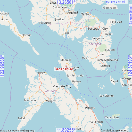
Bagahanlad GPS coordinates[2]
12° 34' 46.92" North, 123° 40' 7.68" East
| Map corner | latitude | longitude |
|---|---|---|
| Upper-left | 13.26501°, | 122.96568° |
| Center: | 12.5797°, | 123.6688° |
| Lower-right: | 11.89255°, | 124.37193° |
| Map W x H: | 152.6×152.6 km | = 94.8×94.8mi |
| max Lat: | 20.78733° ⇑44.5% North |
| Bagahanlad: | 12.5797° |
| min Lat: | ⇓55.5% South 4.65442° |
| min Long | Bagahanlad | max Long |
| 117.04868° | 123.6688° | 126.58417° |
| W 65%⇐ | ⇒35% E |
Elevation
Elevation of Bagahanlad is 58 m = 190 ft, and this is 29.9 m = 98 ft below average elevation for this country.
| Max E: |
2262 m = 7421 ft | 27.8% |
| Avg. | 87.9 m = 288 ft | |
| Bagahanlad | 58 m = 190 ft | |
Min E: |
-2 m = -7 ft | 72.2% |
See also: Philippines elevation on elevation.city.
Geographical zone
Bagahanlad is located in North Torrid zone (between Equator and Tropic of Cancer). Distance of this Northern Tropic circle is 1207.2 km =750.1 mi to North.| Distance of | km | miles | from Bagahanlad |
|---|---|---|---|
| North Pole | 8608.3 | 5348.9 | to North |
| Arctic Circle | 6002.4 | 3729.7 | to North |
| Tropic Cancer | 1207.2 | 750.1 | to North |
| Equator | 1398.7 | 869.1 | to South |


Nearby cities:
15 places around Bagahanlad: (largest is in red/bold)
• Baleno
21.9 km =13.6 mi,  237°
237°
• Batuan
22.7 km =14.1 mi,  153°
153°
• Bulan
24.6 km =15.3 mi,  65°
65°
• Bulo
21.8 km =13.5 mi,  210°
210°
• Butag
29.2 km =18.1 mi,  79°
79°
• Luna
7.8 km =4.8 mi,  115°
115°
• Masbate
23.6 km =14.7 mi,  191°
191°
• Mayngaran
26.7 km =16.6 mi,  196°
196°
• Mobo
27.1 km =16.8 mi,  182°
182°
• Monreal
7.2 km =4.5 mi,  356°
356°
• San Fernando
14.8 km =9.2 mi,  136°
136°
• San Jacinto
7.2 km =4.5 mi,  100°
100°
• Umabay
30.1 km =18.7 mi, 177°
• Usab
29.4 km =18.3 mi, 198°
• Utabi
27 km =16.8 mi, 75°
Sources, notices
• [Note1] Compared only with cities in Philippines existing in our database
• [Src1] Map data: © OpenStreetMap contributors (CC-BY-SA)
• [Src2] Other city data from geonames.org with taken over terms of usage.
• [Src3] Geographical zone / Annual Mean Temperature by Robert A. Rohde @ Wikipedia
