Amadeo geodata
Amadeo (Calabarzon) is a seat of a third-order administrative division; located in Philippines in Asia/Manila (GMT+8) time zone. With population of 16,618 people, there are 411 cities with bigger population in this country. Compared to other cities in Philippines, 71.4% of cities are located further ↓South; 78.6% of cities are located further →East and 95.3% of cities have lower elevation than Amadeo. Note1


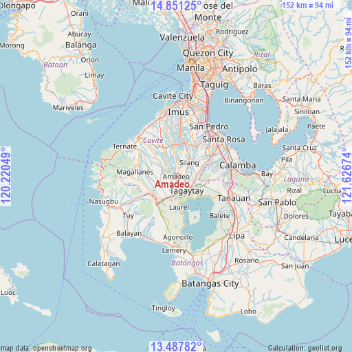
Amadeo GPS coordinates[2]
14° 10' 14.016" North, 120° 55' 24.996" East
| Map corner | latitude | longitude |
|---|---|---|
| Upper-left | 14.85125°, | 120.22049° |
| Center: | 14.17056°, | 120.92361° |
| Lower-right: | 13.48782°, | 121.62674° |
| Map W x H: | 151.6×151.6 km | = 94.2×94.2mi |
| max Lat: | 20.78733° ⇑28.6% North |
| Amadeo: | 14.17056° |
| min Lat: | ⇓71.4% South 4.65442° |
| min Long | Amadeo | max Long |
| 117.04868° | 120.92361° | 126.58417° |
| W 21.4%⇐ | ⇒78.6% E |
Elevation
Elevation of Amadeo is 437 m = 1434 ft, and this is 349.1 m = 1145 ft above average elevation for this country.
| Max E: |
2262 m = 7421 ft | 4.7% |
| Amadeo | 437 m 1434 ft | |
| Avg. | 87.9 m = 288 ft | |
Min E: |
-2 m = -7 ft | 95.3% |
See also: Philippines elevation on elevation.city.
Geographical zone
Amadeo is located in North Torrid zone (between Equator and Tropic of Cancer). Distance of this Northern Tropic circle is 1030.3 km =640.2 mi to North.| Distance of | km | miles | from Amadeo |
|---|---|---|---|
| North Pole | 8431.4 | 5239 | to North |
| Arctic Circle | 5825.6 | 3619.9 | to North |
| Tropic Cancer | 1030.3 | 640.2 | to North |
| Equator | 1575.6 | 979 | to South |


Nearby cities:
15 places around Amadeo: (largest is in red/bold)
• Alfonso
8.2 km =5.1 mi,  246°
246°
• Anuling
6.2 km =3.9 mi,  213°
213°
• Balite Segundo
5.6 km =3.5 mi,  75°
75°
• Guyam Malaki
7 km =4.3 mi, 253°
• Indang
5.7 km =3.5 mi,  298°
298°
• Luksuhin
9.4 km =5.8 mi, 209°
• Lumil
9.4 km =5.8 mi, 82°
• Malabag
4.8 km =3 mi,  110°
110°
• Mangas
8.5 km =5.3 mi,  226°
226°
• Mendez-Nuñez
5 km =3.1 mi,  202°
202°
• Pangil
3.8 km =2.4 mi,  333°
333°
• Patuto
7.6 km =4.7 mi,  142°
142°
• Silang
7.2 km =4.5 mi,  45°
45°
• Tagaytay
8.4 km =5.2 mi,  172°
172°
• Taywanak Ilaya
8.4 km =5.2 mi,  260°
260°
Sources, notices
• [Note1] Compared only with cities in Philippines existing in our database
• [Src1] Map data: © OpenStreetMap contributors (CC-BY-SA)
• [Src2] Other city data from geonames.org with taken over terms of usage.
• [Src3] Geographical zone / Annual Mean Temperature by Robert A. Rohde @ Wikipedia
