Alabat geodata
Alabat (Calabarzon) is a populated place; located in Philippines in Asia/Manila (GMT+8) time zone. With population of 7,910 people, there are 778 cities with bigger population in this country. Compared to other cities in Philippines, 70.4% of cities are located further ↓South; 60.1% of cities are located further →East and 97.1% of cities have higher elevation than Alabat. Note1


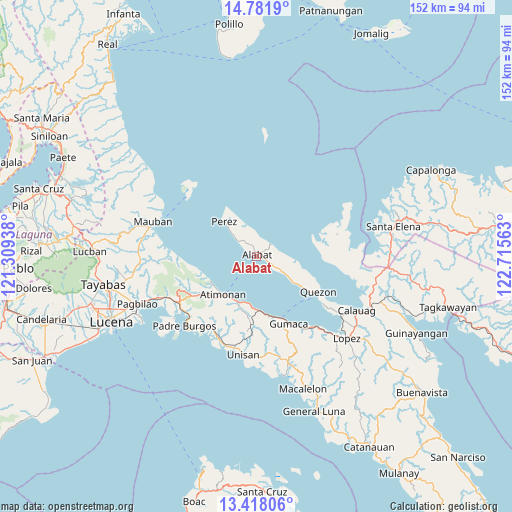
Alabat GPS coordinates[2]
14° 6' 3.6" North, 122° 0' 45" East
| Map corner | latitude | longitude |
|---|---|---|
| Upper-left | 14.7819°, | 121.30938° |
| Center: | 14.101°, | 122.0125° |
| Lower-right: | 13.41806°, | 122.71563° |
| Map W x H: | 151.6×151.6 km | = 94.2×94.2mi |
| max Lat: | 20.78733° ⇑29.6% North |
| Alabat: | 14.101° |
| min Lat: | ⇓70.4% South 4.65442° |
| min Long | Alabat | max Long |
| 117.04868° | 122.0125° | 126.58417° |
| W 39.9%⇐ | ⇒60.1% E |
Elevation
Elevation of Alabat is 4 m = 13 ft, and this is 83.9 m = 275 ft below average elevation for this country.
| Max E: |
2262 m = 7421 ft | 97.1% |
| Avg. | 87.9 m = 288 ft | |
| Alabat | 4 m = 13 ft | |
Min E: |
-2 m = -7 ft | 2.9% |
See also: Philippines elevation on elevation.city.
Geographical zone
Alabat is located in North Torrid zone (between Equator and Tropic of Cancer). Distance of this Northern Tropic circle is 1038 km =645 mi to North.| Distance of | km | miles | from Alabat |
|---|---|---|---|
| North Pole | 8439.2 | 5243.9 | to North |
| Arctic Circle | 5833.3 | 3624.6 | to North |
| Tropic Cancer | 1038 | 645 | to North |
| Equator | 1567.9 | 974.2 | to South |


Nearby cities:
15 places around Alabat: (largest is in red/bold)
• Agdangan
27.1 km =16.8 mi,  203°
203°
• Atimonan
14.7 km =9.1 mi,  222°
222°
• Camohaguin
27.1 km =16.8 mi,  142°
142°
• Gumaca
22.1 km =13.7 mi,  154°
154°
• Mabunga
27.1 km =16.8 mi,  167°
167°
• Mainit Norte
7.8 km =4.8 mi,  337°
337°
• Malicboy
27.5 km =17.1 mi,  241°
241°
• Malinao Ilaya
22.3 km =13.9 mi, 238°
• Marao
29.1 km =18.1 mi, 224°
• Panikihan
25 km =15.5 mi, 149°
• Perez
14 km =8.7 mi,  318°
318°
• Plaridel
16.2 km =10.1 mi,  176°
176°
• Progreso
23 km =14.3 mi,  158°
158°
• Quezon
21.3 km =13.2 mi,  119°
119°
• Santa Cecilia
20.4 km =12.7 mi,  88°
88°
Sources, notices
• [Note1] Compared only with cities in Philippines existing in our database
• [Src1] Map data: © OpenStreetMap contributors (CC-BY-SA)
• [Src2] Other city data from geonames.org with taken over terms of usage.
• [Src3] Geographical zone / Annual Mean Temperature by Robert A. Rohde @ Wikipedia
