Tangi geodata
Tangi (Khyber Pakhtunkhwa) is a populated place; located in Pakistan in Asia/Karachi (GMT+5) time zone. With population of 29,444 people, there are 210 cities with bigger population in this country. Compared to other cities in Pakistan, 94.1% of cities are located further ↓South; 51.9% of cities are located further ←West and 79.5% of cities have lower elevation than Tangi. Note1


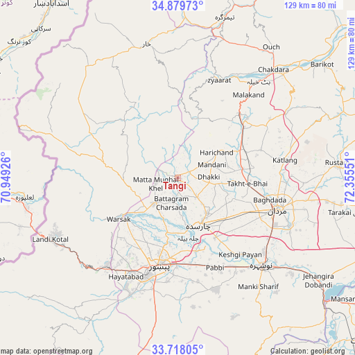
Tangi GPS coordinates[2]
34° 18' 3.24" North, 71° 39' 8.568" East
| Map corner | latitude | longitude |
|---|---|---|
| Upper-left | 34.87973°, | 70.94926° |
| Center: | 34.3009°, | 71.65238° |
| Lower-right: | 33.71805°, | 72.35551° |
| Map W x H: | 129.2×129.2 km | = 80.3×80.3mi |
| max Lat: | 36.32162° ⇑5.9% North |
| Tangi: | 34.3009° |
| min Lat: | ⇓94.1% South 24.14422° |
| min Long | Tangi | max Long |
| 61.74573° | 71.65238° | 75.63372° |
| W 51.9%⇐ | ⇒48.1% E |
Elevation
Elevation of Tangi is 358 m = 1175 ft, and this is 13 m = 43 ft above average elevation for this country.
| Max E: |
2732 m = 8963 ft | 20.5% |
| Tangi | 358 m 1175 ft | |
| Avg. | 345 m = 1132 ft | |
Min E: |
3 m = 10 ft | 79.5% |
See also: Pakistan elevation on elevation.city.
Geographical zone
Tangi is located in North temperate zone (between Tropic of Cancer and the Arctic Circle). Distance of this Northern Tropic circle is 1208 km =750.6 mi to South.| Distance of | km | miles | from Tangi |
|---|---|---|---|
| North Pole | 6193.2 | 3848.3 | to North |
| Arctic Circle | 3587.3 | 2229 | to North |
| Tropic Cancer | 1208 | 750.6 | to South |
| Equator | 3813.9 | 2369.8 | to South |


Nearby cities:
15 places around Tangi: (largest is in red/bold)
• Aman Garh
41.6 km =25.8 mi,  142°
142°
• Bat Khela
45.9 km =28.5 mi,  39°
39°
• Charsadda
18.8 km =11.7 mi,  154°
154°
• Landi Kotal
52.1 km =32.4 mi,  244°
244°
• Malakand
38.9 km =24.2 mi, 40°
• Mardan
38.3 km =23.8 mi,  107°
107°
• Noorabad
29.4 km =18.3 mi,  100°
100°
• Nowshera
43.8 km =27.2 mi, 136°
• Nowshera Cantonment
46.3 km =28.8 mi, 136°
• Pabbi
34.9 km =21.7 mi,  158°
158°
• Peshawar
33.3 km =20.7 mi,  191°
191°
• Risalpur Cantonment
41.2 km =25.6 mi,  130°
130°
• Shabqadar
13 km =8.1 mi,  223°
223°
• Shinpokh
43.6 km =27.1 mi,  274°
274°
• Utmanzai
16.2 km =10.1 mi, 141°
Sources, notices
• [Note1] Compared only with cities in Pakistan existing in our database
• [Src1] Map data: © OpenStreetMap contributors (CC-BY-SA)
• [Src2] Other city data from geonames.org with taken over terms of usage.
• [Src3] Geographical zone / Annual Mean Temperature by Robert A. Rohde @ Wikipedia
