Bat Khela geodata
Bat Khela (Khyber Pakhtunkhwa) is a populated place; located in Pakistan in Asia/Karachi (GMT+5) time zone. With population of 46,079 people, there are 138 cities with bigger population in this country. Compared to other cities in Pakistan, 95.9% of cities are located further ↓South; 56.9% of cities are located further ←West and 84.9% of cities have lower elevation than Bat Khela. Note1


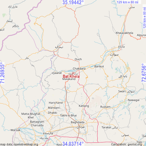
Bat Khela GPS coordinates[2]
34° 37' 4.08" North, 71° 58' 20.892" East
| Map corner | latitude | longitude |
|---|---|---|
| Upper-left | 35.19442°, | 71.26935° |
| Center: | 34.6178°, | 71.97247° |
| Lower-right: | 34.03714°, | 72.6756° |
| Map W x H: | 128.7×128.7 km | = 80×80mi |
| max Lat: | 36.32162° ⇑4.1% North |
| Bat Khela: | 34.6178° |
| min Lat: | ⇓95.9% South 24.14422° |
| min Long | Bat Khela | max Long |
| 61.74573° | 71.97247° | 75.63372° |
| W 56.9%⇐ | ⇒43.1% E |
Elevation
Elevation of Bat Khela is 673 m = 2208 ft, and this is 328 m = 1076 ft above average elevation for this country.
| Max E: |
2732 m = 8963 ft | 15.1% |
| Bat Khela | 673 m 2208 ft | |
| Avg. | 345 m = 1132 ft | |
Min E: |
3 m = 10 ft | 84.9% |
See also: Bat Khela elevation on elevation.city.
Geographical zone
Bat Khela is located in North temperate zone (between Tropic of Cancer and the Arctic Circle). Distance of this Northern Tropic circle is 1243.2 km =772.5 mi to South.| Distance of | km | miles | from Bat Khela |
|---|---|---|---|
| North Pole | 6157.9 | 3826.3 | to North |
| Arctic Circle | 3552 | 2207.1 | to North |
| Tropic Cancer | 1243.2 | 772.5 | to South |
| Equator | 3849.1 | 2391.7 | to South |


Nearby cities:
15 places around Bat Khela: (largest is in red/bold)
• Ashanagro Koto
62 km =38.5 mi,  156°
156°
• Charsadda
56.4 km =35 mi,  202°
202°
• Daggar
48.4 km =30.1 mi,  104°
104°
• Kakad Wari Dir Upper
43.3 km =26.9 mi,  12°
12°
• Malakand
7 km =4.3 mi,  213°
213°
• Mardan
47.2 km =29.3 mi,  171°
171°
• Mingora
39.9 km =24.8 mi,  63°
63°
• Noorabad
40.7 km =25.3 mi,  180°
180°
• Risalpur Cantonment
62 km =38.5 mi, 178°
• Saidu Sharif
37.8 km =23.5 mi,  67°
67°
• Shabqadar
58.9 km =36.6 mi,  220°
220°
• Tangi
45.9 km =28.5 mi, 219°
• Timargara
26 km =16.2 mi,  333°
333°
• Upper Dir
66.1 km =41.1 mi,  352°
352°
• Utmanzai
51.5 km =32 mi, 201°
Sources, notices
• [Note1] Compared only with cities in Pakistan existing in our database
• [Src1] Map data: © OpenStreetMap contributors (CC-BY-SA)
• [Src2] Other city data from geonames.org with taken over terms of usage.
• [Src3] Geographical zone / Annual Mean Temperature by Robert A. Rohde @ Wikipedia
