Surkhpur geodata
Surkhpur (Punjab) is a populated place; located in Pakistan in Asia/Karachi (GMT+5) time zone. With population of 20,000 people, there are 271 cities with bigger population in this country. Compared to other cities in Pakistan, 79.2% of cities are located further ↓South; 95.7% of cities are located further ←West and 70.7% of cities have lower elevation than Surkhpur. Note1


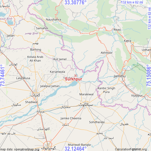
Surkhpur GPS coordinates[2]
32° 43' 5.376" North, 74° 26' 51.828" East
| Map corner | latitude | longitude |
|---|---|---|
| Upper-left | 33.30776°, | 73.74461° |
| Center: | 32.71816°, | 74.44773° |
| Lower-right: | 32.12464°, | 75.15086° |
| Map W x H: | 131.6×131.6 km | = 81.8×81.8mi |
| max Lat: | 36.32162° ⇑20.8% North |
| Surkhpur: | 32.71816° |
| min Lat: | ⇓79.2% South 24.14422° |
| min Long | Surkhpur | max Long |
| 61.74573° | 74.44773° | 75.63372° |
| W 95.7%⇐ | ⇒4.3% E |
Elevation
Elevation of Surkhpur is 247 m = 810 ft, and this is 98 m = 322 ft below average elevation for this country.
| Max E: |
2732 m = 8963 ft | 29.3% |
| Avg. | 345 m = 1132 ft | |
| Surkhpur | 247 m = 810 ft | |
Min E: |
3 m = 10 ft | 70.7% |
See also: Pakistan elevation on elevation.city.
Geographical zone
Surkhpur is located in North temperate zone (between Tropic of Cancer and the Arctic Circle). Distance of this Northern Tropic circle is 1032 km =641.3 mi to South.| Distance of | km | miles | from Surkhpur |
|---|---|---|---|
| North Pole | 6369.1 | 3957.6 | to North |
| Arctic Circle | 3763.3 | 2338.4 | to North |
| Tropic Cancer | 1032 | 641.3 | to South |
| Equator | 3637.9 | 2260.5 | to South |


Nearby cities:
15 places around Surkhpur: (largest is in red/bold)
• Begowala
35.4 km =22 mi,  208°
208°
• Bhimbar
44.8 km =27.8 mi,  309°
309°
• Bhopalwala
33 km =20.5 mi,  193°
193°
• Daska Kalan
44.7 km =27.8 mi, 191°
• Dhaunkal
45.3 km =28.1 mi,  220°
220°
• Gujrat
38.4 km =23.9 mi,  245°
245°
• Hadali
14.3 km =8.9 mi,  127°
127°
• Jalalpur Jattan
24.2 km =15 mi, 249°
• Kot Ghulam Muhammad
43.8 km =27.2 mi,  167°
167°
• Kot Rajkour
38 km =23.6 mi,  153°
153°
• Kotli Loharan
15 km =9.3 mi,  162°
162°
• Sambrial
28.1 km =17.5 mi,  198°
198°
• Sialkot
26.3 km =16.3 mi, 162°
• Sodhri
37.8 km =23.5 mi, 221°
• Wazirabad
43.3 km =26.9 mi,  225°
225°
Sources, notices
• [Note1] Compared only with cities in Pakistan existing in our database
• [Src1] Map data: © OpenStreetMap contributors (CC-BY-SA)
• [Src2] Other city data from geonames.org with taken over terms of usage.
• [Src3] Geographical zone / Annual Mean Temperature by Robert A. Rohde @ Wikipedia
