Sangla Hill geodata
Sangla Hill (Punjab) is a populated place; located in Pakistan in Asia/Karachi (GMT+5) time zone. With population of 57,002 people, there are 120 cities with bigger population in this country. Compared to other cities in Pakistan, 60.9% of cities are located further ↓South; 79.2% of cities are located further ←West and 56.2% of cities have lower elevation than Sangla Hill. Note1


Sangla Hill GPS coordinates[2]
31° 43' 0.012" North, 73° 22' 59.988" East
| Map corner | latitude | longitude |
|---|---|---|
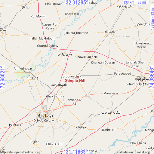
| Upper-left | 32.31285°, | 72.68021° |
| Center: | 31.71667°, | 73.38333° |
| Lower-right: | 31.11663°, | 74.08646° |
| Map W x H: | 133×133 km | = 82.6×82.6mi |
| max Lat: | 36.32162° ⇑39.1% North |
| Sangla Hill: | 31.71667° |
| min Lat: | ⇓60.9% South 24.14422° |
| min Long | Sangla Hill | max Long |
| 61.74573° | 73.38333° | 75.63372° |
| W 79.2%⇐ | ⇒20.8% E |
Elevation
Elevation of Sangla Hill is 194 m = 636 ft, and this is 151 m = 495 ft below average elevation for this country.
| Max E: |
2732 m = 8963 ft | 43.8% |
| Avg. | 345 m = 1132 ft | |
| Sangla Hill | 194 m = 636 ft | |
Min E: |
3 m = 10 ft | 56.2% |
See also: Sangla Hill elevation on elevation.city.
Geographical zone
Sangla Hill is located in North temperate zone (between Tropic of Cancer and the Arctic Circle). Distance of this Northern Tropic circle is 920.6 km =572 mi to South.| Distance of | km | miles | from Sangla Hill |
|---|---|---|---|
| North Pole | 6480.5 | 4026.8 | to North |
| Arctic Circle | 3874.6 | 2407.6 | to North |
| Tropic Cancer | 920.6 | 572 | to South |
| Equator | 3526.6 | 2191.3 | to South |


Nearby cities:
15 places around Sangla Hill: (largest is in red/bold)
• Chak Five Hundred Seventy-five
46.3 km =28.8 mi,  114°
114°
• Chak Jhumra
25.1 km =15.6 mi,  228°
228°
• Chenab Nagar
44.6 km =27.7 mi,  275°
275°
• Chiniot
38.3 km =23.8 mi,  270°
270°
• Chuchar-kana Mandi
39.6 km =24.6 mi,  84°
84°
• Faisalabad
43.5 km =27 mi,  219°
219°
• Jaranwala
42.8 km =26.6 mi,  175°
175°
• Kaleke Mandi
35.4 km =22 mi,  35°
35°
• Khangah Dogran
26 km =16.2 mi,  60°
60°
• Khurrianwala
26.5 km =16.5 mi,  204°
204°
• Mananwala
32.3 km =20.1 mi,  116°
116°
• Nankana Sahib
42.6 km =26.5 mi,  134°
134°
• Pindi Bhattian
22.7 km =14.1 mi,  332°
332°
• Shahkot
18.9 km =11.7 mi,  149°
149°
• Sukheke Mandi
20.3 km =12.6 mi, 35°
Sources, notices
• [Note1] Compared only with cities in Pakistan existing in our database
• [Src1] Map data: © OpenStreetMap contributors (CC-BY-SA)
• [Src2] Other city data from geonames.org with taken over terms of usage.
• [Src3] Geographical zone / Annual Mean Temperature by Robert A. Rohde @ Wikipedia
