Zdziechowice geodata
Zdziechowice (Opole Voivodeship) is a populated place; located in Poland in Europe/Warsaw (GMT+2) time zone. With population of 753 people, there are 2946 cities with bigger population in this country. Compared to other cities in Poland, 52.7% of cities are located further ↑North; 69.9% of cities are located further →East and 57.7% of cities have lower elevation than Zdziechowice. Note1
Administrative division(s):
- Level 1: Opole Voivodeship
- Level 2: Powiat oleski
- Level 3: Gorzów Śląski


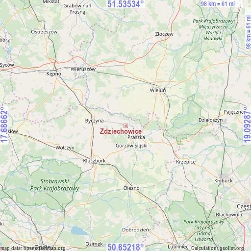
Zdziechowice GPS coordinates[2]
51° 5' 45.132" North, 18° 23' 23.064" East
| Map corner | latitude | longitude |
|---|---|---|
| Upper-left | 51.53534°, | 17.68662° |
| Center: | 51.09587°, | 18.38974° |
| Lower-right: | 50.65218°, | 19.09287° |
| Map W x H: | 98.2×98.2 km | = 61×61mi |
| max Lat: | 54.83135° ⇑52.7% North |
| Zdziechowice: | 51.09587° |
| min Lat: | ⇓47.3% South 49.21328° |
| min Long | Zdziechowice | max Long |
| 14.20249° | 18.38974° | 24.03723° |
| W 30.1%⇐ | ⇒69.9% E |
Elevation
Elevation of Zdziechowice is 193 m = 633 ft, and this is 1.6 m = 5 ft above average elevation for this country.
| Max E: |
974 m = 3196 ft | 42.3% |
| Zdziechowice | 193 m 633 ft | |
| Avg. | 191.4 m = 628 ft | |
Min E: |
-3 m = -10 ft | 57.7% |
See also: Poland elevation on elevation.city.
Geographical zone
Zdziechowice is located in North temperate zone (between Tropic of Cancer and the Arctic Circle). Distance of this North polar circle is 1719.8 km =1068.6 mi to North.| Distance of | km | miles | from Zdziechowice |
|---|---|---|---|
| North Pole | 4325.7 | 2687.9 | to North |
| Arctic Circle | 1719.8 | 1068.6 | to North |
| Tropic Cancer | 3075.4 | 1911 | to South |
| Equator | 5681.3 | 3530.2 | to South |


Nearby cities:
15 places around Zdziechowice: (largest is in red/bold)
• Bolesławiec
17.9 km =11.1 mi,  309°
309°
• Byczyna
12.4 km =7.7 mi,  279°
279°
• Dalachów
13.3 km =8.3 mi,  98°
98°
• Dzietrzkowice
8.2 km =5.1 mi,  326°
326°
• Gorzów Śląski
7.8 km =4.8 mi,  162°
162°
• Kowale
6.2 km =3.9 mi,  106°
106°
• Mokrsko
11.5 km =7.1 mi,  36°
36°
• Ożarów
10.1 km =6.3 mi,  57°
57°
• Praszka
6.4 km =4 mi,  136°
136°
• Przedmość
3.2 km =2 mi,  94°
94°
• Pątnów
16.7 km =10.4 mi,  71°
71°
• Rudniki
15.9 km =9.9 mi, 113°
• Skomlin
8.3 km =5.2 mi,  358°
358°
• Wróblew
5.6 km =3.5 mi,  11°
11°
• Łubnice
10.3 km =6.4 mi,  317°
317°
Sources, notices
• [Note1] Compared only with cities in Poland existing in our database
• [Src1] Map data: © OpenStreetMap contributors (CC-BY-SA)
• [Src2] Other city data from geonames.org with taken over terms of usage.
• [Src3] Geographical zone / Annual Mean Temperature by Robert A. Rohde @ Wikipedia
