Gorzów Śląski geodata
Gorzów Śląski (Opole Voivodeship) is a seat of a third-order administrative division; located in Poland in Europe/Warsaw (GMT+2) time zone. With population of 2,300 people, there are 1321 cities with bigger population in this country. Compared to other cities in Poland, 54.6% of cities are located further ↑North; 69.3% of cities are located further →East and 57.7% of cities have lower elevation than Gorzów Śląski. Note1
Administrative division(s):
- Level 1: Opole Voivodeship
- Level 2: Powiat oleski
- Level 3: Gorzów Śląski


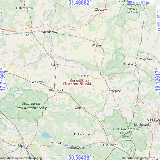
Gorzów Śląski GPS coordinates[2]
51° 1' 43.356" North, 18° 25' 22.944" East
| Map corner | latitude | longitude |
|---|---|---|
| Upper-left | 51.46882°, | 17.71992° |
| Center: | 51.02871°, | 18.42304° |
| Lower-right: | 50.58438°, | 19.12617° |
| Map W x H: | 98.3×98.3 km | = 61.1×61.1mi |
| max Lat: | 54.83135° ⇑54.6% North |
| Gorzów Śląski: | 51.02871° |
| min Lat: | ⇓45.4% South 49.21328° |
| min Long | Gorzów Śląsk | max Long |
| 14.20249° | 18.42304° | 24.03723° |
| W 30.7%⇐ | ⇒69.3% E |
Elevation
Elevation of Gorzów Śląski is 193 m = 633 ft, and this is 1.6 m = 5 ft above average elevation for this country.
| Max E: |
974 m = 3196 ft | 42.3% |
| Gorzów Śląski | 193 m 633 ft | |
| Avg. | 191.4 m = 628 ft | |
Min E: |
-3 m = -10 ft | 57.7% |
See also: Poland elevation on elevation.city.
Geographical zone
Gorzów Śląski is located in North temperate zone (between Tropic of Cancer and the Arctic Circle). Distance of this North polar circle is 1727.3 km =1073.3 mi to North.| Distance of | km | miles | from Gorzów Śląski |
|---|---|---|---|
| North Pole | 4333.2 | 2692.5 | to North |
| Arctic Circle | 1727.3 | 1073.3 | to North |
| Tropic Cancer | 3067.9 | 1906.3 | to South |
| Equator | 5673.9 | 3525.6 | to South |


Nearby cities:
15 places around Gorzów Śląski: (largest is in red/bold)
• Dalachów
12.1 km =7.5 mi,  63°
63°
• Dzietrzkowice
15.9 km =9.9 mi,  334°
334°
• Kluczbork
15.6 km =9.7 mi,  246°
246°
• Kowale
6.7 km =4.2 mi,  32°
32°
• Mokrsko
17.3 km =10.7 mi,  15°
15°
• Olesno
16.9 km =10.5 mi,  180°
180°
• Ożarów
14.3 km =8.9 mi, 25°
• Praszka
3.5 km =2.2 mi,  37°
37°
• Przedmość
7.2 km =4.5 mi,  7°
7°
• Radłow
13.2 km =8.2 mi,  143°
143°
• Rudniki
12.3 km =7.6 mi,  84°
84°
• Skomlin
16 km =9.9 mi,  350°
350°
• Wojciechów
14.8 km =9.2 mi,  188°
188°
• Wróblew
13 km =8.1 mi, 354°
• Zdziechowice
7.8 km =4.8 mi,  342°
342°
Sources, notices
• [Note1] Compared only with cities in Poland existing in our database
• [Src1] Map data: © OpenStreetMap contributors (CC-BY-SA)
• [Src2] Other city data from geonames.org with taken over terms of usage.
• [Src3] Geographical zone / Annual Mean Temperature by Robert A. Rohde @ Wikipedia
