Zawady geodata
Zawady (Silesia) is a populated place; located in Poland in Europe/Warsaw (GMT+2) time zone. With population of 959 people, there are 2579 cities with bigger population in this country. Compared to other cities in Poland, 54.8% of cities are located further ↑North; 61.6% of cities are located further →East and 62.4% of cities have lower elevation than Zawady. Note1


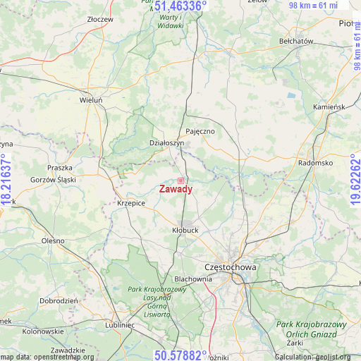
Zawady GPS coordinates[2]
51° 1' 23.52" North, 18° 55' 10.164" East
| Map corner | latitude | longitude |
|---|---|---|
| Upper-left | 51.46336°, | 18.21637° |
| Center: | 51.0232°, | 18.91949° |
| Lower-right: | 50.57882°, | 19.62262° |
| Map W x H: | 98.4×98.4 km | = 61.1×61.1mi |
| max Lat: | 54.83135° ⇑54.8% North |
| Zawady: | 51.0232° |
| min Lat: | ⇓45.2% South 49.21328° |
| min Long | Zawady | max Long |
| 14.20249° | 18.91949° | 24.03723° |
| W 38.4%⇐ | ⇒61.6% E |
Elevation
Elevation of Zawady is 207 m = 679 ft, and this is 15.6 m = 51 ft above average elevation for this country.
| Max E: |
974 m = 3196 ft | 37.6% |
| Zawady | 207 m 679 ft | |
| Avg. | 191.4 m = 628 ft | |
Min E: |
-3 m = -10 ft | 62.4% |
See also: Poland elevation on elevation.city.
Geographical zone
Zawady is located in North temperate zone (between Tropic of Cancer and the Arctic Circle). Distance of this North polar circle is 1727.9 km =1073.7 mi to North.| Distance of | km | miles | from Zawady |
|---|---|---|---|
| North Pole | 4333.8 | 2692.9 | to North |
| Arctic Circle | 1727.9 | 1073.7 | to North |
| Tropic Cancer | 3067.3 | 1905.9 | to South |
| Equator | 5673.2 | 3525.2 | to South |


Nearby cities:
15 places around Zawady: (largest is in red/bold)
• Działoszyn
11.1 km =6.9 mi,  340°
340°
• Kamyk
15.5 km =9.6 mi,  150°
150°
• Krzepice
14.6 km =9.1 mi,  246°
246°
• Kłobuck
13.7 km =8.5 mi,  174°
174°
• Lipie
8.7 km =5.4 mi,  262°
262°
• Miedzno
7.3 km =4.5 mi,  143°
143°
• Nowa Brzeźnica
19.5 km =12.1 mi,  70°
70°
• Opatów
10.3 km =6.4 mi,  223°
223°
• Ostrowy nad Okszą
10.6 km =6.6 mi,  118°
118°
• Pajęczno
14.5 km =9 mi,  21°
21°
• Panki
19.5 km =12.1 mi, 217°
• Popów
2.1 km =1.3 mi, 23°
• Truskolasy
18.5 km =11.5 mi,  200°
200°
• Wręczyca Wielka
19.7 km =12.2 mi,  179°
179°
• Łobodno
11.4 km =7.1 mi, 154°
Sources, notices
• [Note1] Compared only with cities in Poland existing in our database
• [Src1] Map data: © OpenStreetMap contributors (CC-BY-SA)
• [Src2] Other city data from geonames.org with taken over terms of usage.
• [Src3] Geographical zone / Annual Mean Temperature by Robert A. Rohde @ Wikipedia
