Nowa Brzeźnica geodata
Nowa Brzeźnica (Łódź Voivodeship) is a section of populated place; located in Poland in Europe/Warsaw (GMT+2) time zone. With population of 750 people, there are 2953 cities with bigger population in this country. Compared to other cities in Poland, 53.2% of cities are located further ↑North; 56.4% of cities are located further →East and 60.6% of cities have lower elevation than Nowa Brzeźnica. Note1
Administrative division(s):
- Level 1: Łódź Voivodeship
- Level 2: Powiat pajęczański
- Level 3: Nowa Brzeźnica


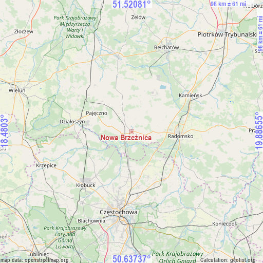
Nowa Brzeźnica GPS coordinates[2]
51° 4' 52.32" North, 19° 11' 0.312" East
| Map corner | latitude | longitude |
|---|---|---|
| Upper-left | 51.52081°, | 18.4803° |
| Center: | 51.0812°, | 19.18342° |
| Lower-right: | 50.63737°, | 19.88655° |
| Map W x H: | 98.2×98.2 km | = 61×61mi |
| max Lat: | 54.83135° ⇑53.2% North |
| Nowa Brzeźnica: | 51.0812° |
| min Lat: | ⇓46.8% South 49.21328° |
| min Long | Nowa Brzeźnica | max Long |
| 14.20249° | 19.18342° | 24.03723° |
| W 43.6%⇐ | ⇒56.4% E |
Elevation
Elevation of Nowa Brzeźnica is 202 m = 663 ft, and this is 10.6 m = 35 ft above average elevation for this country.
| Max E: |
974 m = 3196 ft | 39.4% |
| Nowa Brzeźnica | 202 m 663 ft | |
| Avg. | 191.4 m = 628 ft | |
Min E: |
-3 m = -10 ft | 60.6% |
See also: Poland elevation on elevation.city.
Geographical zone
Nowa Brzeźnica is located in North temperate zone (between Tropic of Cancer and the Arctic Circle). Distance of this North polar circle is 1721.5 km =1069.7 mi to North.| Distance of | km | miles | from Nowa Brzeźnica |
|---|---|---|---|
| North Pole | 4327.4 | 2688.9 | to North |
| Arctic Circle | 1721.5 | 1069.7 | to North |
| Tropic Cancer | 3073.8 | 1910 | to South |
| Equator | 5679.7 | 3529.2 | to South |


Nearby cities:
15 places around Nowa Brzeźnica: (largest is in red/bold)
• Bogusławice
14.9 km =9.3 mi,  159°
159°
• Borowno
17.7 km =11 mi, 159°
• Dobroszyce
17.4 km =10.8 mi,  66°
66°
• Kleszczów
17.9 km =11.1 mi,  28°
28°
• Kruszyna
14.3 km =8.9 mi,  152°
152°
• Lgota Wielka
12.6 km =7.8 mi,  53°
53°
• Mykanów
17.6 km =10.9 mi,  176°
176°
• Ostrowy nad Okszą
14.6 km =9.1 mi,  218°
218°
• Pajęczno
14.8 km =9.2 mi,  298°
298°
• Popów
18.2 km =11.3 mi,  255°
255°
• Radomsko
18.3 km =11.4 mi,  94°
94°
• Radziechowice Pierwsze
10 km =6.2 mi,  98°
98°
• Rząśnia
18.3 km =11.4 mi,  327°
327°
• Strzelce Wielkie
7 km =4.3 mi,  337°
337°
• Sulmierzyce
11.5 km =7.1 mi,  4°
4°
Sources, notices
• [Note1] Compared only with cities in Poland existing in our database
• [Src1] Map data: © OpenStreetMap contributors (CC-BY-SA)
• [Src2] Other city data from geonames.org with taken over terms of usage.
• [Src3] Geographical zone / Annual Mean Temperature by Robert A. Rohde @ Wikipedia
