Wapno geodata
Wapno (Greater Poland) is a seat of a third-order administrative division; located in Poland in Europe/Warsaw (GMT+2) time zone. With population of 1,700 people, there are 1678 cities with bigger population in this country. Compared to other cities in Poland, 82.5% of cities are located further ↓South; 80.2% of cities are located further →East and 79.3% of cities have higher elevation than Wapno. Note1


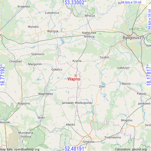
Wapno GPS coordinates[2]
52° 54' 28.944" North, 17° 28' 30.144" East
| Map corner | latitude | longitude |
|---|---|---|
| Upper-left | 53.33002°, | 16.77192° |
| Center: | 52.90804°, | 17.47504° |
| Lower-right: | 52.48191°, | 18.17817° |
| Map W x H: | 94.3×94.3 km | = 58.6×58.6mi |
| max Lat: | 54.83135° ⇑17.5% North |
| Wapno: | 52.90804° |
| min Lat: | ⇓82.5% South 49.21328° |
| min Long | Wapno | max Long |
| 14.20249° | 17.47504° | 24.03723° |
| W 19.8%⇐ | ⇒80.2% E |
Elevation
Elevation of Wapno is 101 m = 331 ft, and this is 90.4 m = 297 ft below average elevation for this country.
| Max E: |
974 m = 3196 ft | 79.3% |
| Avg. | 191.4 m = 628 ft | |
| Wapno | 101 m = 331 ft | |
Min E: |
-3 m = -10 ft | 20.7% |
See also: Poland elevation on elevation.city.
Geographical zone
Wapno is located in North temperate zone (between Tropic of Cancer and the Arctic Circle). Distance of this North polar circle is 1518.4 km =943.5 mi to North.| Distance of | km | miles | from Wapno |
|---|---|---|---|
| North Pole | 4124.2 | 2562.7 | to North |
| Arctic Circle | 1518.4 | 943.5 | to North |
| Tropic Cancer | 3276.9 | 2036.2 | to South |
| Equator | 5882.8 | 3655.4 | to South |


Nearby cities:
15 places around Wapno: (largest is in red/bold)
• Brzyskorzystewko
14.7 km =9.1 mi,  96°
96°
• Damasławek
7.8 km =4.8 mi,  167°
167°
• Gołańcz
12.4 km =7.7 mi,  288°
288°
• Gąsawa
24.5 km =15.2 mi,  129°
129°
• Janowiec Wielkopolski
17 km =10.6 mi,  176°
176°
• Kcynia
9.4 km =5.8 mi,  5°
5°
• Kołaczkowo
25 km =15.5 mi,  56°
56°
• Królikowo
11.5 km =7.1 mi, 60°
• Margonin
26.5 km =16.5 mi, 285°
• Mieścisko
20.7 km =12.9 mi,  207°
207°
• Rogowo
23.6 km =14.7 mi,  149°
149°
• Sarbinowo
14.3 km =8.9 mi,  116°
116°
• Szubin
21 km =13 mi, 57°
• Wągrowiec
21.6 km =13.4 mi,  239°
239°
• Żnin
17.7 km =11 mi,  111°
111°
Sources, notices
• [Note1] Compared only with cities in Poland existing in our database
• [Src1] Map data: © OpenStreetMap contributors (CC-BY-SA)
• [Src2] Other city data from geonames.org with taken over terms of usage.
• [Src3] Geographical zone / Annual Mean Temperature by Robert A. Rohde @ Wikipedia
