Damasławek geodata
Damasławek (Greater Poland) is a seat of a third-order administrative division; located in Poland in Europe/Warsaw (GMT+2) time zone. With population of 2,500 people, there are 1240 cities with bigger population in this country. Compared to other cities in Poland, 81.4% of cities are located further ↓South; 79.8% of cities are located further →East and 75.4% of cities have higher elevation than Damasławek. Note1


Damasławek GPS coordinates[2]
52° 50' 23.244" North, 17° 30' 2.232" East
| Map corner | latitude | longitude |
|---|---|---|
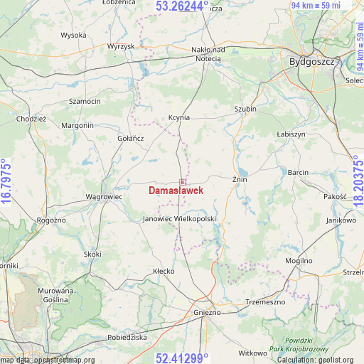
| Upper-left | 53.26244°, | 16.7975° |
| Center: | 52.83979°, | 17.50062° |
| Lower-right: | 52.41299°, | 18.20375° |
| Map W x H: | 94.4×94.4 km | = 58.7×58.7mi |
| max Lat: | 54.83135° ⇑18.6% North |
| Damasławek: | 52.83979° |
| min Lat: | ⇓81.4% South 49.21328° |
| min Long | Damasławek | max Long |
| 14.20249° | 17.50062° | 24.03723° |
| W 20.2%⇐ | ⇒79.8% E |
Elevation
Elevation of Damasławek is 110 m = 361 ft, and this is 81.4 m = 267 ft below average elevation for this country.
| Max E: |
974 m = 3196 ft | 75.4% |
| Avg. | 191.4 m = 628 ft | |
| Damasławek | 110 m = 361 ft | |
Min E: |
-3 m = -10 ft | 24.6% |
See also: Poland elevation on elevation.city.
Geographical zone
Damasławek is located in North temperate zone (between Tropic of Cancer and the Arctic Circle). Distance of this North polar circle is 1525.9 km =948.2 mi to North.| Distance of | km | miles | from Damasławek |
|---|---|---|---|
| North Pole | 4131.8 | 2567.4 | to North |
| Arctic Circle | 1525.9 | 948.2 | to North |
| Tropic Cancer | 3269.3 | 2031.4 | to South |
| Equator | 5875.2 | 3650.7 | to South |


Nearby cities:
15 places around Damasławek: (largest is in red/bold)
• Brzyskorzystewko
14.1 km =8.8 mi,  65°
65°
• Gołańcz
17.7 km =11 mi,  310°
310°
• Gąsawa
18.9 km =11.7 mi,  115°
115°
• Janowiec Wielkopolski
9.4 km =5.8 mi,  184°
184°
• Kcynia
16.9 km =10.5 mi,  357°
357°
• Królikowo
15.7 km =9.8 mi,  31°
31°
• Kłecko
23.6 km =14.7 mi,  191°
191°
• Mieleszyn
19 km =11.8 mi, 180°
• Mieścisko
15.6 km =9.7 mi,  226°
226°
• Rogowo
16.3 km =10.1 mi,  141°
141°
• Sarbinowo
11.3 km =7 mi,  83°
83°
• Szubin
24.8 km =15.4 mi,  40°
40°
• Wapno
7.8 km =4.8 mi,  347°
347°
• Wągrowiec
20.5 km =12.7 mi,  260°
260°
• Żnin
14.8 km =9.2 mi,  85°
85°
Sources, notices
• [Note1] Compared only with cities in Poland existing in our database
• [Src1] Map data: © OpenStreetMap contributors (CC-BY-SA)
• [Src2] Other city data from geonames.org with taken over terms of usage.
• [Src3] Geographical zone / Annual Mean Temperature by Robert A. Rohde @ Wikipedia
