Toporzysko geodata
Toporzysko (Kujawsko-Pomorskie) is a populated place; located in Poland in Europe/Warsaw (GMT+2) time zone. With population of 633 people, there are 3200 cities with bigger population in this country. Compared to other cities in Poland, 84.9% of cities are located further ↓South; 71.5% of cities are located further →East and 96.1% of cities have higher elevation than Toporzysko. Note1
Administrative division(s):
- Level 1: Kujawsko-Pomorskie
- Level 2: Powiat toruński
- Level 3: Zławieś Wielka


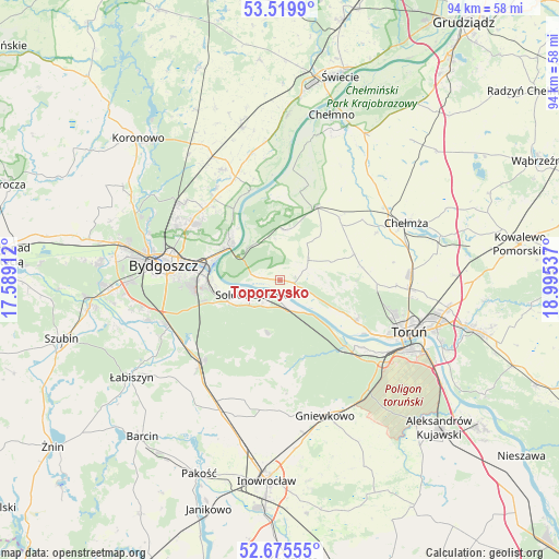
Toporzysko GPS coordinates[2]
53° 5' 59.28" North, 18° 17' 32.064" East
| Map corner | latitude | longitude |
|---|---|---|
| Upper-left | 53.5199°, | 17.58912° |
| Center: | 53.0998°, | 18.29224° |
| Lower-right: | 52.67555°, | 18.99537° |
| Map W x H: | 93.9×93.9 km | = 58.3×58.3mi |
| max Lat: | 54.83135° ⇑15.1% North |
| Toporzysko: | 53.0998° |
| min Lat: | ⇓84.9% South 49.21328° |
| min Long | Toporzysko | max Long |
| 14.20249° | 18.29224° | 24.03723° |
| W 28.5%⇐ | ⇒71.5% E |
Elevation
Elevation of Toporzysko is 31 m = 102 ft, and this is 160.4 m = 526 ft below average elevation for this country.
| Max E: |
974 m = 3196 ft | 96.1% |
| Avg. | 191.4 m = 628 ft | |
| Toporzysko | 31 m = 102 ft | |
Min E: |
-3 m = -10 ft | 3.9% |
See also: Poland elevation on elevation.city.
Geographical zone
Toporzysko is located in North temperate zone (between Tropic of Cancer and the Arctic Circle). Distance of this North polar circle is 1497 km =930.2 mi to North.| Distance of | km | miles | from Toporzysko |
|---|---|---|---|
| North Pole | 4102.9 | 2549.4 | to North |
| Arctic Circle | 1497 | 930.2 | to North |
| Tropic Cancer | 3298.2 | 2049.4 | to South |
| Equator | 5904.1 | 3668.6 | to South |


Nearby cities:
15 places around Toporzysko: (largest is in red/bold)
• Bydgoszcz
19.2 km =11.9 mi,  277°
277°
• Chełmża
22.9 km =14.2 mi,  65°
65°
• Dobrcz
20.8 km =12.9 mi,  332°
332°
• Dąbrowa Chełmińska
8.4 km =5.2 mi,  5°
5°
• Fordon
9.8 km =6.1 mi,  303°
303°
• Nowa Wieś Wielka
19.6 km =12.2 mi,  223°
223°
• Osielsko
16.8 km =10.4 mi, 304°
• Rojewo
22 km =13.7 mi,  182°
182°
• Solec Kujawski
4.8 km =3 mi,  248°
248°
• Toruń
22.6 km =14 mi,  115°
115°
• Unisław
14 km =8.7 mi,  26°
26°
• Wielka Nieszawka
18.5 km =11.5 mi,  128°
128°
• Zławieś Wielka
2.5 km =1.6 mi,  100°
100°
• Łubianka
13.3 km =8.3 mi, 71°
• Łysomice
21.9 km =13.6 mi,  93°
93°
Sources, notices
• [Note1] Compared only with cities in Poland existing in our database
• [Src1] Map data: © OpenStreetMap contributors (CC-BY-SA)
• [Src2] Other city data from geonames.org with taken over terms of usage.
• [Src3] Geographical zone / Annual Mean Temperature by Robert A. Rohde @ Wikipedia
