Szydłowo geodata
Szydłowo (Greater Poland) is a seat of a third-order administrative division; located in Poland in Europe/Warsaw (GMT+2) time zone. With population of 750 people, there are 2953 cities with bigger population in this country. Compared to other cities in Poland, 85.9% of cities are located further ↓South; 88.7% of cities are located further →East and 66.4% of cities have higher elevation than Szydłowo. Note1


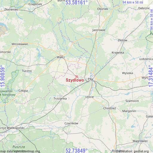
Szydłowo GPS coordinates[2]
53° 9' 43.632" North, 16° 36' 42.156" East
| Map corner | latitude | longitude |
|---|---|---|
| Upper-left | 53.58161°, | 15.90859° |
| Center: | 53.16212°, | 16.61171° |
| Lower-right: | 52.73849°, | 17.31484° |
| Map W x H: | 93.7×93.7 km | = 58.2×58.2mi |
| max Lat: | 54.83135° ⇑14.1% North |
| Szydłowo: | 53.16212° |
| min Lat: | ⇓85.9% South 49.21328° |
| min Long | Szydłowo | max Long |
| 14.20249° | 16.61171° | 24.03723° |
| W 11.3%⇐ | ⇒88.7% E |
Elevation
Elevation of Szydłowo is 129 m = 423 ft, and this is 62.4 m = 205 ft below average elevation for this country.
| Max E: |
974 m = 3196 ft | 66.4% |
| Avg. | 191.4 m = 628 ft | |
| Szydłowo | 129 m = 423 ft | |
Min E: |
-3 m = -10 ft | 33.6% |
See also: Poland elevation on elevation.city.
Geographical zone
Szydłowo is located in North temperate zone (between Tropic of Cancer and the Arctic Circle). Distance of this North polar circle is 1490.1 km =925.9 mi to North.| Distance of | km | miles | from Szydłowo |
|---|---|---|---|
| North Pole | 4096 | 2545.1 | to North |
| Arctic Circle | 1490.1 | 925.9 | to North |
| Tropic Cancer | 3305.2 | 2053.8 | to South |
| Equator | 5911.1 | 3673 | to South |


Nearby cities:
15 places around Szydłowo: (largest is in red/bold)
• Chodzież
27.7 km =17.2 mi,  132°
132°
• Czarnków
29.1 km =18.1 mi,  186°
186°
• Kaczory
19.2 km =11.9 mi,  109°
109°
• Krajenka
29.4 km =18.3 mi,  59°
59°
• Miasteczko Krajeńskie
27.2 km =16.9 mi, 105°
• Piła
8.5 km =5.3 mi,  98°
98°
• Siedlisko
24.7 km =15.3 mi,  217°
217°
• Skrzatusz
5.1 km =3.2 mi,  336°
336°
• Tarnówka
25.6 km =15.9 mi,  38°
38°
• Trzcianka
17 km =10.6 mi, 217°
• Tuczno
30.7 km =19.1 mi,  276°
276°
• Ujście
14.5 km =9 mi,  146°
146°
• Wałcz
15.9 km =9.9 mi,  323°
323°
• Wysoka
31.5 km =19.6 mi,  86°
86°
• Śmiłowo
20.8 km =12.9 mi, 97°
Sources, notices
• [Note1] Compared only with cities in Poland existing in our database
• [Src1] Map data: © OpenStreetMap contributors (CC-BY-SA)
• [Src2] Other city data from geonames.org with taken over terms of usage.
• [Src3] Geographical zone / Annual Mean Temperature by Robert A. Rohde @ Wikipedia
