Świekatowo geodata
Świekatowo (Kujawsko-Pomorskie) is a populated place; located in Poland in Europe/Warsaw (GMT+2) time zone. With population of 1,077 people, there are 2382 cities with bigger population in this country. Compared to other cities in Poland, 88.7% of cities are located further ↓South; 74.2% of cities are located further →East and 77.6% of cities have higher elevation than Świekatowo. Note1


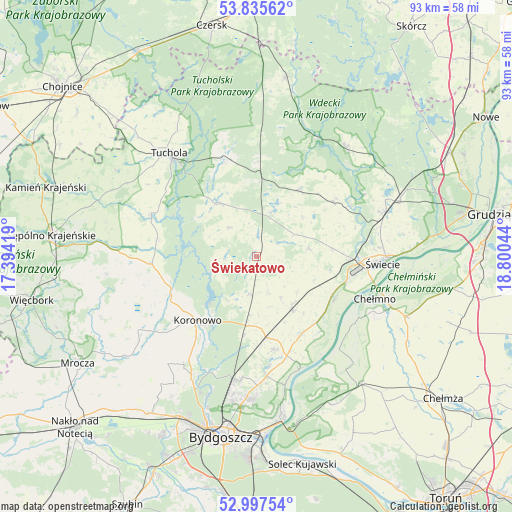
Świekatowo GPS coordinates[2]
53° 25' 7.104" North, 18° 5' 50.316" East
| Map corner | latitude | longitude |
|---|---|---|
| Upper-left | 53.83562°, | 17.39419° |
| Center: | 53.41864°, | 18.09731° |
| Lower-right: | 52.99754°, | 18.80044° |
| Map W x H: | 93.2×93.2 km | = 57.9×57.9mi |
| max Lat: | 54.83135° ⇑11.3% North |
| Świekatowo: | 53.41864° |
| min Lat: | ⇓88.7% South 49.21328° |
| min Long | Świekatowo | max Long |
| 14.20249° | 18.09731° | 24.03723° |
| W 25.8%⇐ | ⇒74.2% E |
Elevation
Elevation of Świekatowo is 104 m = 341 ft, and this is 87.4 m = 287 ft below average elevation for this country.
| Max E: |
974 m = 3196 ft | 77.6% |
| Avg. | 191.4 m = 628 ft | |
| Świekatowo | 104 m = 341 ft | |
Min E: |
-3 m = -10 ft | 22.4% |
See also: Poland elevation on elevation.city.
Geographical zone
Świekatowo is located in North temperate zone (between Tropic of Cancer and the Arctic Circle). Distance of this North polar circle is 1461.6 km =908.2 mi to North.| Distance of | km | miles | from Świekatowo |
|---|---|---|---|
| North Pole | 4067.5 | 2527.4 | to North |
| Arctic Circle | 1461.6 | 908.2 | to North |
| Tropic Cancer | 3333.7 | 2071.5 | to South |
| Equator | 5939.6 | 3690.7 | to South |


Nearby cities:
15 places around Świekatowo: (largest is in red/bold)
• Bukowiec
9.6 km =6 mi,  79°
79°
• Cekcyn
18.1 km =11.2 mi,  341°
341°
• Chełmno
23.1 km =14.4 mi,  109°
109°
• Dobrcz
17.4 km =10.8 mi,  168°
168°
• Drzycim
17 km =10.6 mi,  55°
55°
• Gostycyn
20.6 km =12.8 mi,  292°
292°
• Kamienica
20.1 km =12.5 mi, 289°
• Koronowo
15.8 km =9.8 mi,  222°
222°
• Lniano
14.4 km =8.9 mi,  32°
32°
• Lubiewo
6.9 km =4.3 mi,  319°
319°
• Osie
25.9 km =16.1 mi,  39°
39°
• Osielsko
26 km =16.2 mi,  181°
181°
• Pruszcz
11.9 km =7.4 mi,  145°
145°
• Tuchola
24.5 km =15.2 mi, 320°
• Świecie
23.2 km =14.4 mi,  92°
92°
Sources, notices
• [Note1] Compared only with cities in Poland existing in our database
• [Src1] Map data: © OpenStreetMap contributors (CC-BY-SA)
• [Src2] Other city data from geonames.org with taken over terms of usage.
• [Src3] Geographical zone / Annual Mean Temperature by Robert A. Rohde @ Wikipedia
