Bukowiec geodata
Bukowiec (Kujawsko-Pomorskie) is a populated place; located in Poland in Europe/Warsaw (GMT+2) time zone. With population of 1,210 people, there are 2157 cities with bigger population in this country. Compared to other cities in Poland, 88.9% of cities are located further ↓South; 72% of cities are located further →East and 82.7% of cities have higher elevation than Bukowiec. Note1


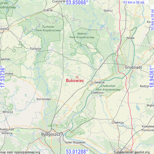
Bukowiec GPS coordinates[2]
53° 26' 1.788" North, 18° 14' 25.728" East
| Map corner | latitude | longitude |
|---|---|---|
| Upper-left | 53.85066°, | 17.53736° |
| Center: | 53.43383°, | 18.24048° |
| Lower-right: | 53.01288°, | 18.94361° |
| Map W x H: | 93.2×93.2 km | = 57.9×57.9mi |
| max Lat: | 54.83135° ⇑11.1% North |
| Bukowiec: | 53.43383° |
| min Lat: | ⇓88.9% South 49.21328° |
| min Long | Bukowiec | max Long |
| 14.20249° | 18.24048° | 24.03723° |
| W 28%⇐ | ⇒72% E |
Elevation
Elevation of Bukowiec is 94 m = 308 ft, and this is 97.4 m = 320 ft below average elevation for this country.
| Max E: |
974 m = 3196 ft | 82.7% |
| Avg. | 191.4 m = 628 ft | |
| Bukowiec | 94 m = 308 ft | |
Min E: |
-3 m = -10 ft | 17.3% |
See also: Poland elevation on elevation.city.
Geographical zone
Bukowiec is located in North temperate zone (between Tropic of Cancer and the Arctic Circle). Distance of this North polar circle is 1459.9 km =907.1 mi to North.| Distance of | km | miles | from Bukowiec |
|---|---|---|---|
| North Pole | 4065.8 | 2526.4 | to North |
| Arctic Circle | 1459.9 | 907.1 | to North |
| Tropic Cancer | 3335.4 | 2072.5 | to South |
| Equator | 5941.3 | 3691.8 | to South |


Nearby cities:
15 places around Bukowiec: (largest is in red/bold)
• Cekcyn
21.7 km =13.5 mi,  315°
315°
• Chełmno
15.5 km =9.6 mi,  127°
127°
• Dobrcz
19.7 km =12.2 mi,  198°
198°
• Drzycim
9.2 km =5.7 mi,  29°
29°
• Jeżewo
18.8 km =11.7 mi,  63°
63°
• Kamienica
28.9 km =18 mi,  279°
279°
• Koronowo
24.2 km =15 mi,  236°
236°
• Lniano
10.6 km =6.6 mi,  350°
350°
• Lubiewo
14.4 km =8.9 mi, 284°
• Osie
19.6 km =12.2 mi,  20°
20°
• Pruszcz
11.8 km =7.3 mi,  193°
193°
• Stolno
21.5 km =13.4 mi, 125°
• Unisław
26.5 km =16.5 mi,  158°
158°
• Świecie
14 km =8.7 mi,  101°
101°
• Świekatowo
9.6 km =6 mi,  259°
259°
Sources, notices
• [Note1] Compared only with cities in Poland existing in our database
• [Src1] Map data: © OpenStreetMap contributors (CC-BY-SA)
• [Src2] Other city data from geonames.org with taken over terms of usage.
• [Src3] Geographical zone / Annual Mean Temperature by Robert A. Rohde @ Wikipedia
