Lubiewo geodata
Lubiewo (Kujawsko-Pomorskie) is a seat of a third-order administrative division; located in Poland in Europe/Warsaw (GMT+2) time zone. With population of 1,012 people, there are 2445 cities with bigger population in this country. Compared to other cities in Poland, 89.1% of cities are located further ↓South; 74.9% of cities are located further →East and 77.2% of cities have higher elevation than Lubiewo. Note1


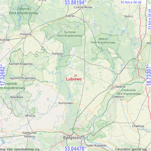
Lubiewo GPS coordinates[2]
53° 27' 55.512" North, 18° 1' 47.784" East
| Map corner | latitude | longitude |
|---|---|---|
| Upper-left | 53.88194°, | 17.32682° |
| Center: | 53.46542°, | 18.02994° |
| Lower-right: | 53.04478°, | 18.73307° |
| Map W x H: | 93.1×93.1 km | = 57.8×57.8mi |
| max Lat: | 54.83135° ⇑10.9% North |
| Lubiewo: | 53.46542° |
| min Lat: | ⇓89.1% South 49.21328° |
| min Long | Lubiewo | max Long |
| 14.20249° | 18.02994° | 24.03723° |
| W 25.1%⇐ | ⇒74.9% E |
Elevation
Elevation of Lubiewo is 105 m = 344 ft, and this is 86.4 m = 283 ft below average elevation for this country.
| Max E: |
974 m = 3196 ft | 77.2% |
| Avg. | 191.4 m = 628 ft | |
| Lubiewo | 105 m = 344 ft | |
Min E: |
-3 m = -10 ft | 22.8% |
See also: Poland elevation on elevation.city.
Geographical zone
Lubiewo is located in North temperate zone (between Tropic of Cancer and the Arctic Circle). Distance of this North polar circle is 1456.4 km =905 mi to North.| Distance of | km | miles | from Lubiewo |
|---|---|---|---|
| North Pole | 4062.3 | 2524.2 | to North |
| Arctic Circle | 1456.4 | 905 | to North |
| Tropic Cancer | 3338.9 | 2074.7 | to South |
| Equator | 5944.8 | 3693.9 | to South |


Nearby cities:
15 places around Lubiewo: (largest is in red/bold)
• Bukowiec
14.4 km =8.9 mi,  104°
104°
• Cekcyn
12 km =7.5 mi,  354°
354°
• Dobrcz
23.6 km =14.7 mi,  160°
160°
• Drzycim
19 km =11.8 mi,  76°
76°
• Gostycyn
14.8 km =9.2 mi,  280°
280°
• Kamienica
14.6 km =9.1 mi, 275°
• Koronowo
18 km =11.2 mi,  200°
200°
• Kęsowo
23.2 km =14.4 mi,  296°
296°
• Lniano
13.9 km =8.6 mi,  60°
60°
• Osie
25.5 km =15.8 mi,  54°
54°
• Pruszcz
18.7 km =11.6 mi,  143°
143°
• Raciąż
27.1 km =16.8 mi,  323°
323°
• Sośno
24.2 km =15 mi,  249°
249°
• Tuchola
17.7 km =11 mi, 320°
• Świekatowo
6.9 km =4.3 mi, 139°
Sources, notices
• [Note1] Compared only with cities in Poland existing in our database
• [Src1] Map data: © OpenStreetMap contributors (CC-BY-SA)
• [Src2] Other city data from geonames.org with taken over terms of usage.
• [Src3] Geographical zone / Annual Mean Temperature by Robert A. Rohde @ Wikipedia
