Dobrcz geodata
Dobrcz (Kujawsko-Pomorskie) is a populated place; located in Poland in Europe/Warsaw (GMT+2) time zone. With population of 891 people, there are 2693 cities with bigger population in this country. Compared to other cities in Poland, 87.1% of cities are located further ↓South; 73.5% of cities are located further →East and 84.1% of cities have higher elevation than Dobrcz. Note1


Dobrcz GPS coordinates[2]
53° 15' 55.692" North, 18° 8' 53.268" East
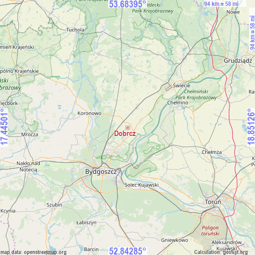
| Map corner | latitude | longitude |
|---|---|---|
| Upper-left | 53.68395°, | 17.44501° |
| Center: | 53.26547°, | 18.14813° |
| Lower-right: | 52.84285°, | 18.85126° |
| Map W x H: | 93.5×93.5 km | = 58.1×58.1mi |
| max Lat: | 54.83135° ⇑12.9% North |
| Dobrcz: | 53.26547° |
| min Lat: | ⇓87.1% South 49.21328° |
| min Long | Dobrcz | max Long |
| 14.20249° | 18.14813° | 24.03723° |
| W 26.5%⇐ | ⇒73.5% E |
Elevation
Elevation of Dobrcz is 91 m = 299 ft, and this is 100.4 m = 329 ft below average elevation for this country.
| Max E: |
974 m = 3196 ft | 84.1% |
| Avg. | 191.4 m = 628 ft | |
| Dobrcz | 91 m = 299 ft | |
Min E: |
-3 m = -10 ft | 15.9% |
See also: Poland elevation on elevation.city.
Geographical zone
Dobrcz is located in North temperate zone (between Tropic of Cancer and the Arctic Circle). Distance of this North polar circle is 1478.6 km =918.8 mi to North.| Distance of | km | miles | from Dobrcz |
|---|---|---|---|
| North Pole | 4084.5 | 2538 | to North |
| Arctic Circle | 1478.6 | 918.8 | to North |
| Tropic Cancer | 3316.6 | 2060.8 | to South |
| Equator | 5922.6 | 3680.1 | to South |


Nearby cities:
15 places around Dobrcz: (largest is in red/bold)
• Bukowiec
19.7 km =12.2 mi,  18°
18°
• Bydgoszcz
18.4 km =11.4 mi,  210°
210°
• Chełmno
20.6 km =12.8 mi,  63°
63°
• Dąbrowa Chełmińska
14.5 km =9 mi,  133°
133°
• Fordon
13.1 km =8.1 mi,  173°
173°
• Koronowo
15 km =9.3 mi,  290°
290°
• Lubiewo
23.6 km =14.7 mi,  340°
340°
• Osielsko
9.9 km =6.2 mi, 205°
• Pruszcz
8 km =5 mi,  25°
25°
• Sicienko
24.1 km =15 mi,  253°
253°
• Solec Kujawski
20.9 km =13 mi, 165°
• Toporzysko
20.8 km =12.9 mi,  152°
152°
• Unisław
16.9 km =10.5 mi,  110°
110°
• Zławieś Wielka
22.4 km =13.9 mi, 147°
• Świekatowo
17.4 km =10.8 mi,  348°
348°
Sources, notices
• [Note1] Compared only with cities in Poland existing in our database
• [Src1] Map data: © OpenStreetMap contributors (CC-BY-SA)
• [Src2] Other city data from geonames.org with taken over terms of usage.
• [Src3] Geographical zone / Annual Mean Temperature by Robert A. Rohde @ Wikipedia
